AGENDA #10f
BUDGET WORKING PAPER
TO: W. Calvin Horton, Town Manager
FROM: Roger Waldon, Planning Director
SUBJECT: Funding to Increase the Number of Bicycle Lanes and to Promote Greater Bicycle Ridership
DATE: April 27, 2005
This working paper reviews a request from the Community Design Commission that the 2005-06 budget include funds to increase the number of bike lanes and to promote greater bicycle ridership.
BACKGROUND
In November 2003, the Town Council adopted a revised bicycle facilities policy which calls for the provision of striped bicycle lanes on newly constructed or reconstructed arterial streets and for either striped bicycle lanes or wide outside lanes on Collector Streets depending on site specific circumstances. (Please see Attachment 1).
The policy recognizes that the appropriate design, type and width of bicycle facilities will be assessed on an individual and site-specific basis depending on the circumstances that exist as listed in the policy. The Town Manager has been authorized by the Town Council to use this policy in reviewing development plans and in the design of roadway improvements within the Chapel Hill Planning Jurisdiction.
On October 27, 2004 the Town Council adopted a Bicycle and Pedestrian Action Plan as a component of the Town’s Comprehensive Plan. It is a long-range plan to guide future decisions about the provision of facilities for bicyclists and pedestrians. It identifies locations throughout the Town where improved bicycle and pedestrian facilities are desired and recommends a series of actions to work toward the provision of improved facilities.
The plan identifies a list of proposed advisory bicycle routes. These are primarily located on Town-maintained streets and connect parts of the town via local and collector streets as alternatives to more heavily trafficked arterial streets (please see Attachment 2).
The Plan also identifies street corridors where bicycle and pedestrian improvements are desired and which may include the provisions of (bicycle lanes/wide outside lanes). These are primarily located on State-maintained streets. It also identifies on State-maintained street intersections in the Town which are perceived as barriers to cyclists and pedestrians (please see Attachment 2).
Attachment 2 also shows the bicycle facility improvements that are included on the Chapel Hill Transportation Priority List. The majority of the corridors and intersections identified in the Bicycle and Pedestrian Action Plan are located on State-maintained streets. Improvements would require the approval of the North Carolina Department of Transportation (NCDOT) and funding would primarily be the responsibility of the NCDOT. Funding is being sought through the process for developing The State Transportation Improvement Program, and where eligible, through Surface Transportation Direct Allocation Program (STPDA), the Congestion Management and Air Quality Program (CMAQ), the North Carolina Moving Ahead Program (State Roads Improvement Initiative) and the North Carolina Transportation Enhancement Program. The Action Plan is a tool for identifying the Town’s vision and planning for the long-term provision of these facilities through development and planned State road improvements.
DISCUSSION
We believe that State funds should be used to make improvements on State-maintained streets and that Town funds should generally be used to make improvements on Town-maintained streets.
Status of State Funding:
· 4 foot wide shoulders were installed on Homestead Road from High School Road to Airport Road during the summer of 2004.
· 4 foot wide shoulders will be installed later this year on Estes Drive Extension from Seawell School Road to Airport Road.
· Striped bicycle lanes are included in the following State road improvement projects under construction:
§ US 15-501(South) north of Main St. Southern Village to Culbreth Rd. 2005
· Striped bicycle lanes are currently included in the draft 2006-2012 State Transportation Improvement Program:
§ S. Columbia Street from South Fordham Blvd. to Manning Drive in year 2009
§ Weaver Dairy Road entire length in year 2009
Status of Local Funding:
At the local level on Town–maintained streets the Action Plan identifies locations for signed bicycle advisory routes. In October 2004 the Town sold $4 million in bonds as the first of four projected bond sales between 2004 and 2009. The first issue includes $300,000 for traffic calming and bicycle and pedestrian safety improvements.
On January 24, 2005 the Town Council adopted a Sidewalks and Bicycle Facilities Construction Plan for 2004-05 (resolution attached). The elements in the construction plan related to bicycle facilities are as follows:
Bicycle Advisory Routes:
Town Maintained streets: $30,000 approved for signing the following three advisory bicycle routes as pilot projects:
- Finley Golf Course Road/Old Mason Farm Road (from NC Highway 54 to South Fordham Boulevard.)
- Cleland Drive/Cleland Road (from Pinehurst Drive to existing off-road path at Fordham Boulevard.)
- Burning Tree Drive/Pinehurst Drive (from NC Highway 54 to Ephesus Church Road.)
The Town Council also resolved to request the North Carolina Department of Transportation (NCDOT) to undertake feasibility studies to identify improved facilities for bicyclists and pedestrians for:
· the following proposed shared bicycle and pedestrian off-road paths:
§ 15- 501 S. Fordham Boulevard from Manning Dr to Kings Mill Rd.
§ 15- 501 S. Fordham Boulevard by-pass from Old Mason Farm Rd to Prestwick Rd.
§ Fordham Blvd (north) from rear of Binkley Baptist Church to Estes Dr.
§ Christopher Rd, extend a path from the northern end or road to S. Estes Dr.
§ US 15-501 S. Fordham Boulevard from Meadow Lane to Morgan Creek Greenway.
§ NC54 Finley Golf Course Rd to Hamilton Rd (south side).
· the following intersections:
- NC Highway 54 and US 15-501
- NC Highway 54 by-pass and Merritt Mill Road
- US 15-501 South and Culbreth Road and Mount Carmel Church Road
- US 15-501 North and Ephesus Church Road
Town staff is currently working with the North Carolina Department of Transportation to review the desired improvements identified in the Bicycle and Pedestrian Action Plan and in particular the items included in the Towns resolution approving the 2004-2005 sidewalks and bicycle construction plan (2005-01-24/R-8a). (Please see Attachment 3).
CONCLUSION
The Bicycle and Pedestrian Action Plan provides the long-term vision for improving bicycle and pedestrian facilities in the Town. The plan can be implemented using Federal, State and Town funds where eligible. We believe that Town funds should generally be used to make improvements on Town-maintained streets and State funds on State-maintained streets. The Action Plan shows that many of the improvements desired for bicyclists are located on State- maintained streets. The Town staff will continue to work with North Carolina Department of Transportation to identify opportunities for improvements as listed in the Council’s resolution of January 24, 2005.
ATTACHMENTS
- Town of Chapel Hill Bicycle Facilities Policy. Resolution (2003-11-10/R10) (p. 4).
- List of bicycle improvements identified in the Bicycle and Pedestrian Action Plan (p. 5).
- 2004-05 Sidewalk and Bicycle Facilities Construction Plan. Resolution (2005-01-24/R-8a) (p. 7).
A RESOLUTION ADOPTING A POLICY FOR THE CONSTRUCTION OF BICYCLE FACILITIES WITHIN THE TOWN (2003-11-10/R-10)
WHEREAS, it is the goal of the Town of Chapel Hill to accommodate the needs of existing bicyclists; and
WHEREAS, it is the goal of the Town of Chapel Hill to encourage greater use of bicycles as an alternative mode of transportation; and
WHEREAS, the Chapel Hill 2000 Comprehensive Plan includes the objective “develop and maintain a system of safe and efficient bikeways (on-street bike lanes and off-street paths within greenways) designed to contribute to Town-wide mobility, connecting neighborhoods with activity centers, schools, parks, and other neighborhoods”; and
WHEREAS, the Comprehensive Plan recommends the Town “adopt revised roadway standards incorporating on-street bike lanes, including a commitment to install bike lanes in roadway resurfacing projects where feasible; and
WHEREAS, variable circumstances exist in the Town of Chapel Hill such as topography, vehicle speed and volume, impediments such as parked vehicles, drainage grates or raised reflectors, access to public facilities and activity centers and available right of way.
NOW, THEREFORE, BE IT RESOLVED by the Council of the Town of Chapel Hill, that:
- Within the Planning Jurisdiction of the Town of Chapel Hill, the appropriate design, type and width of bicycle facilities will be assessed on an individual and site-specific basis depending on the circumstances that exist.
- Striped bicycle lanes will normally be provided on newly constructed or reconstructed Arterial Streets; however, when existing Arterial Streets that do not currently have bicycle lanes are resurfaced they will normally be re-striped with bicycle lanes to the extent practicable.
- Either striped bicycle lanes or wide outside lanes may be appropriate on Collector Streets depending on site specific circumstances.
- Local Streets will not normally include extra width for bicycle facilities.
BE IT FURTHER RESOLVED that the Council directs the Manager to utilize this policy in reviewing development plans and in the design of roadway improvements within the Chapel Hill Planning Jurisdiction.
BE IT FURTHER RESOLVED that the Bicycle and Pedestrian Action Plan include discussion of the type, design and width of bicycle facilities that may be appropriate for different streets within the Planning Jurisdiction of the Town of Chapel Hill. Until such time that the Action Plan is completed and adopted by the Town Council, Town staff shall recommend bicycle accommodations on a case by case basis and in accordance with this policy, subject to approval by the Town Council.
This the 10th day of November, 2003.
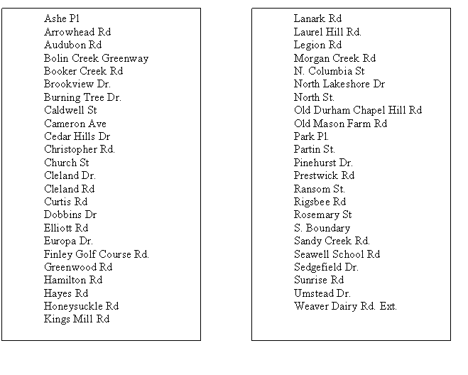
Bicycle Advisory Routes listed in the Bicycle and Pedestrian Action Plan
Bicycle Advisory Routes are identified on the proposed plan to be signed as routes for cyclists. They connect parts of the town via local and collector streets as alternatives to more heavily trafficked arterial streets.
Proposed Corridors for bicycle and pedestrian improvements as identified in Bicycle and Pedestrian Action Plan:
State-Maintained Streets. These locations are also included in the Town of Chapel Hill Transportation Improvement Priority List (for improvements to State-maintained streets).
· Airport Road corridor: From I-40 to North Street *
· Barbee Chapel Rd from NC 54 to Southeastern town limits.
· Erwin Rd from eastern town limits to US 15-501.
· Estes Dr ext. from western town limits to Airport Rd.
· Finley Golf Course Rd from NC 54 to Old Mason fm Rd.
· Fordham Boulevard Corridor: US 15-501 South to Ephesus Church Road*
· Homestead Rd from western town limits to Airport Rd.
· Mason Farm Rd. from South Fordham Blvd. to Finley Golf Course Rd.
· Mount Carmel Church Rd from US 15-501South to Urban Services Boundary.
· NC54 Corridor: Fordham Boulevard to Barbee Chapel Road*
· Old Durham Chapel Hill Rd from northern town limits to US 15-501. (project extends to Durham feasibility in study 2004)
· Piney Mountain Rd from Airport Rd to Rigsbee Rd.
· Pope Rd from Ephesus Church Rd to Old Durham Chapel Hill Rd.
· Seawell School Rd from Estes Dr ext. to Homestead Rd. (feasibility study in 2004)
· US 15-501 from Northeastern town limits to E. Franklin St.
* added to TIP priority list April 5, 2005
Town-Maintained Streets.
Hillsborough Street entire length
Legion Road entire length
Weaver Dairy Road Extension entire length