MEMORANDUM |
|
|
TO: |
Roger L. Stancil, Town Manager |
|
FROM: |
J.B. Culpepper, Planning Director George Small, Engineering Director Gene Poveromo, Development Coordinator Sue Burke, Stormwater Management Engineer |
|
SUBJECT: |
Public Hearing: OWASA Mason Farm Reclaimed Water Storage and Pumping Facility – Special Use Permit Modification Application (File No. 9788-06-5324) |
|
DATE: |
March 19, 2007 |
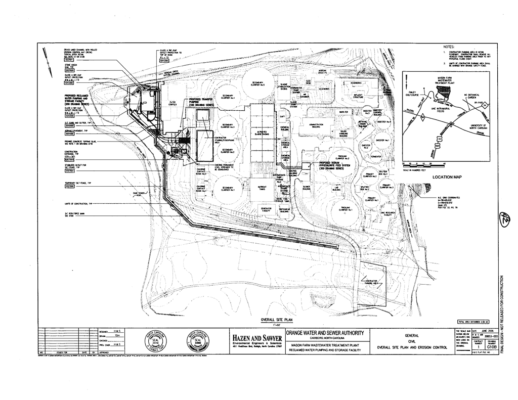
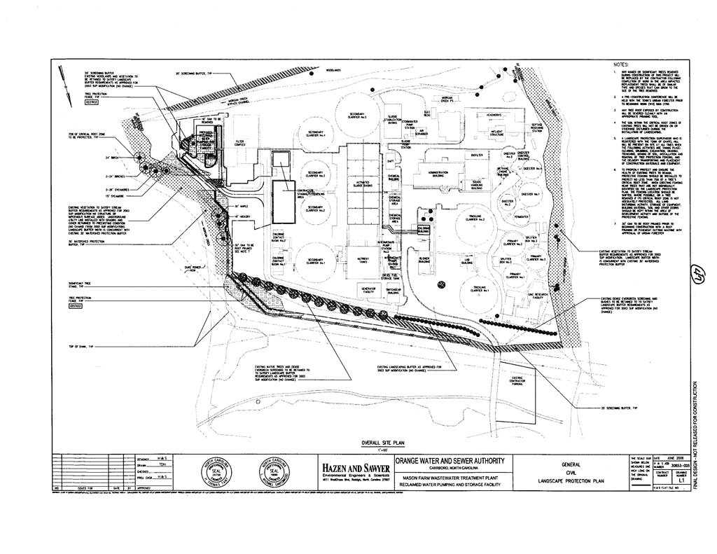
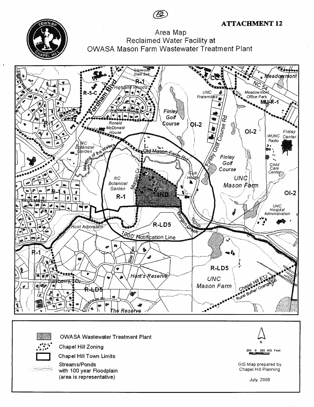
Attached for your consideration is a request for a Special Use Permit Modification for the reclaimed water storage and pumping facility at the Orange Water and Sewer Authority (OWASA) wastewater treatment plant. The facility is located south of Old Mason Farm Road between the North Carolina Botanical Garden and Finley Golf Course. Tonight’s Public Hearing has been scheduled to receive evidence in support of and in opposition to approval of the application, as the Council determines the appropriate requirements to include as conditions of approval.
This package of materials has been prepared for the Town Council’s consideration, and is organized as follows:
The original Special Use Permit for the OWASA Wastewater Treatment Plant was approved by the Council on April 13, 1981. The Council approved the most recent Special Use Permit Modification on March 1, 2004 to expand treatment capacity at the Old Mason Farm Road facility, including odor elimination improvements. The treatment capacity construction is expected to be complete during the summer of 2007.
A Concept Plan Review of this application was conducted by the Community Design Commission on May 17, 2006, and the Council on June 19, 2006 (Attachments 8 and 9). On May 8, 2006, the Town Council granted expedited processing for review of this Special Use Permit Modification application.
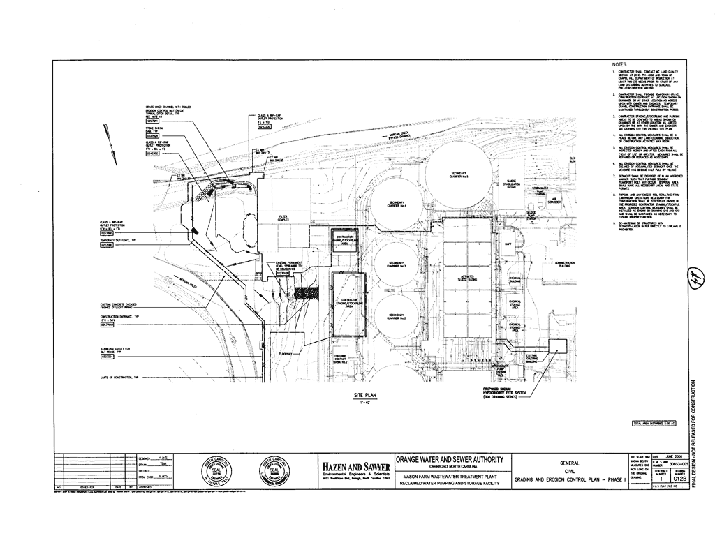
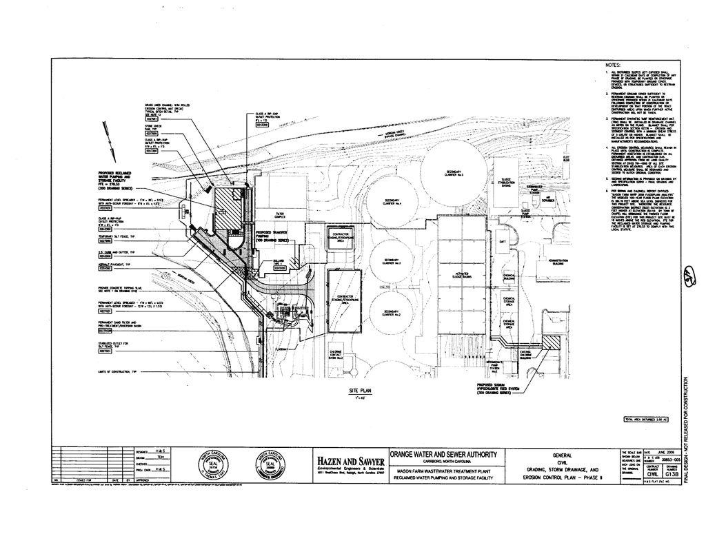
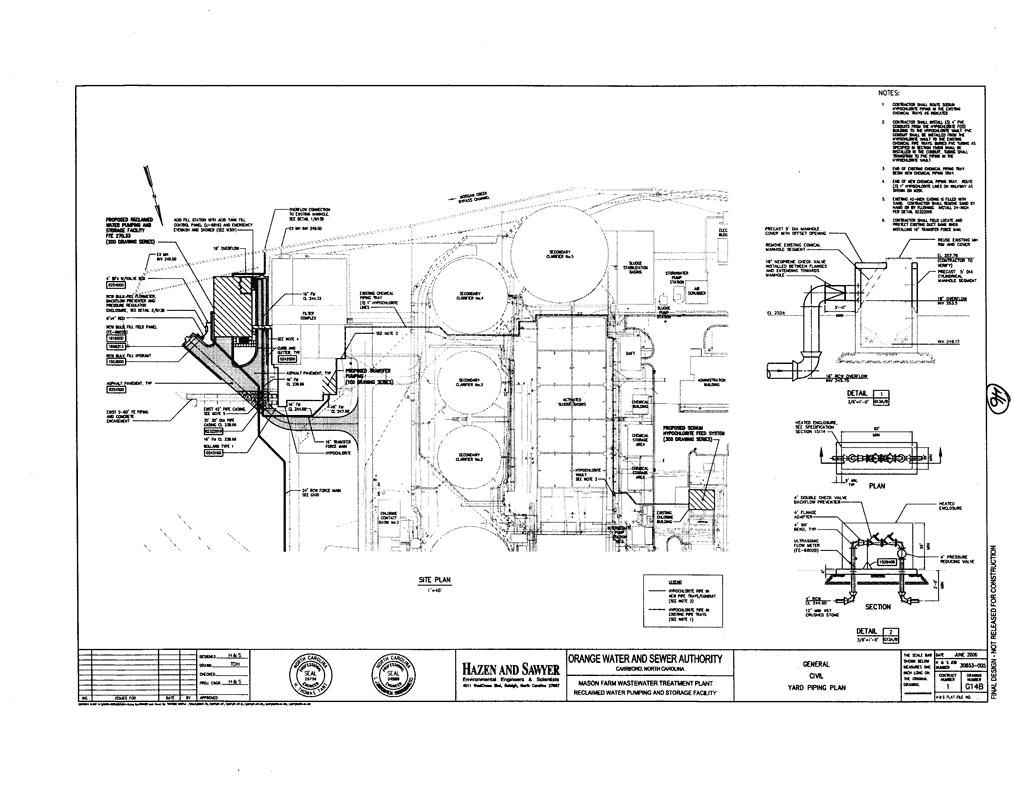
The Special Use Permit Modification application proposes to construct a reclaimed water storage and pumping facility. The applicant is proposing a 5,130 square foot storage tank/pump station building and associated piping. The proposed reclaimed water system would supply cooling tower demands at chiller facilities on the UNC Campus. The State of North Carolina is in the process of approving additional uses for reclaimed water.
The treatment plant is located in the 100-year federally regulated floodplain, the Resource Conservation District and the Watershed Protection District. The 23.4-acre site is located in the Industrial (I) zoning district and is identified as Orange County Parcel Identifier Number 9798-21-3071.
The Land Use Management Ordinance requires the Town Manager to conduct an evaluation of this Special Use Permit Modification, to present a report to the Planning Board, and to present a report and recommendation to the Town Council. We have reviewed the application and evaluated it against Town standards; we have presented a report to the Planning Board; and tonight we submit our report and preliminary recommendation to the Council.
The standard for review and approval of a Special Use Permit Modification application involves consideration of four findings (description of the findings follows below). Evidence will be presented tonight. If, after consideration of the evidence, the Council decides that it can make each of the four findings, the Land Use Management Ordinance directs that the Special Use Permit Modification shall then be approved. If the Council decides that the evidence does not support making one or more of the findings, then the application cannot be approved and, accordingly, should be denied by the Council.
We have evaluated the application regarding its compliance with the standards and regulations of the Town’s Land Use Management Ordinance. Based on our evaluation, our preliminary conclusion is that the application as submitted complies with the regulations and standards of the Land Use Management Ordinance and Design Manual, with the conditions included in Resolution A.
Tonight the Council receives our attached evaluation and information submitted by the applicant and citizens. The applicant’s materials are included as attachments to this memorandum. All information that is submitted at the hearing will be included in the record of the hearing.
Based on the evidence that is submitted, the Council will consider whether or not it can make each of four required findings for the approval of a Special Use Permit.
The four findings are:
Finding #1: That the use or development is located, designed, and proposed to be operated so as to maintain or promote the public health, safety, and general welfare;
Finding #2: That the use or development would comply with all required regulations and standards of the Land Use Management Ordinance;
Finding #3: That the use or development is located, designed, and proposed to be operated so as to maintain or enhance the value of contiguous property, or that the use or development is a public necessity; and
Finding #4: That the use or development conforms with the general plans for the physical development of the Town as embodied in this Chapter and in the Comprehensive Plan.
Following the Public Hearing, we will prepare an evaluation of the evidence submitted in support of and in opposition to this application.
We have identified key issues associated with this development, discussed below.
Comment: Please refer to the Proposed Modification of Regulations section below.
Comment: We recommend that the Town Manager approve a “no rise certificate” prior to issuance of a Zoning Compliance Permit. We have included a stipulation to this effect in Resolution A.
Comment: We have corrected Resolution A. Resolution A includes a reference to sand filters and level spreaders in the vegetated buffers of the Watershed Protection District.
The applicant requests modification to regulations in the Land Use Management Ordinance for intensity standards pertaining to floor area and impervious surface. The Council has the ability to modify the regulations, according to Section 4.5.6 in the Land Use Management Ordinance.
Comment: The applicant is proposing to modify the regulations as they relate to the following requirements in the Land Use Management Ordinance:
Floor Area: The applicant is requesting modification of maximum floor area allowed in the Resource Conservation District, Section 3.6.3-3 of the Land Use Management Ordinance. The maximum allowed floor area for this property is 79,717 square feet. The applicant is proposing 85,810 square feet, or 6,093 square feet over the allowable floor area. The applicant notes that the floor area at the plant has been minimized in the proposed project, that much of the floor space is not frequently occupied and is used to house equipment such as pumps, generators, and other equipment, and that this equipment is vital to the proper operation of the plant.
Comment: The Resource Conservation District has very low intensity floor area ratios. The wastewater treatment facility is located in the Resource Conservation District by necessity because waste is transmitted to the plant by gravity. We believe that public purposes are satisfied to an equivalent or greater degree for the provision of this reclamation facility that will benefit the community. We therefore recommend that the floor area regulations be modified.
Impervious Surface: The applicant is requesting modification of maximum impervious surface area allowed in the Resource Conservation District, Section 3.6.3-3 of the Land Use Management Ordinance. The maximum impervious surface allowed is 222,554 square feet (20%). The applicant is proposing 384,170 square feet (38%) of impervious surface. The proposal would therefore exceed the allowable impervious surface area by 161,616 square, an increase from existing impervious surface of 16,170 square feet.
Comment: We recommend that the impervious surface regulations be modified. As noted above, we believe that public purposes are satisfied to an equivalent or greater degree with this proposal to use reclaimed water to extend the community’s water supply.
The applicant requests that the Council find that public purposes are satisfied to an equivalent or greater degree. Please refer to the attached Statement of Justification for additional justification as presented by the applicant.
In summary, the Council may modify one or more of the proposed modifications to regulations if it makes a finding in the particular case, that public purposes are satisfied to an equivalent or greater degree. The Council may deny one or more of the proposed modifications from regulations at its discretion. If the Council chooses to deny a request for modification to regulations, the applicant’s alternative is to comply with regulations.
We have attached a resolution that includes standard conditions of approval as well as special conditions that we recommend for this application. With these conditions, our preliminary recommendation is that the Council could make the four findings necessary in order to approve the application. Our recommendation, Resolution A, incorporates input from all Town departments involved in review of the application.
Planning Board Recommendation: The Planning Board met on March 6, 2007 and voted 8-0 to recommend that the Council approve the Special Use Permit Modification with the following recommendation:
Comment: We concur. This recommendation of the Planning Board has been incorporated into Resolution A.
Transportation Board Recommendation: The Transportation Board will meet on March 22, 2007. We will provide their recommendation when it is available.
Community Design Commission Recommendation: The Community Design Commission will meet March 21. We will provide their recommendation when it is available.
Bicycle and Pedestrian Advisory Board Recommendation: The Bicycle and Pedestrian Advisory Board will meet March 27. We will provide their recommendation when it is available.
Preliminary Staff Recommendation: We recommend that the Council approve the request for a Special Use Permit Modification with the adoption of Resolution A.
Following tonight’s Public Hearing, we will prepare an evaluation of the evidence submitted in support of and in opposition to this application. If the Council makes the required findings for approval of a Special Use Permit Modification, we recommend that the application be approved with the adoption of Resolution A.
Resolution B would deny the application.
DIFFERENCES AMONG ADVISORY BOARD RECOMMENDATIONS
ISSUE |
Staff Preliminary Recommendation |
Planning Board |
|
Recommendation |
|
|
|
Include Omitted BMP in Watershed Protection District |
Yes |
* |
|
Stormwater Management Plan Stipulation |
Delete text “to the extent practicable” |
Yes |
|
Approval of “No Rise Certificate” Required Prior to Issuance of Zoning Compliance Permit |
Yes |
* |
* Issue was not discussed at this particular meeting.