AGENDA #2b
MEMORANDUM
TO: Mayor and Town Council
FROM: W. Calvin Horton, Town Manager
SUBJECT: Public Hearing: Rosemary Street Mixed Use Development – Application for Special Use Permit
DATE: June 17, 2002
INTRODUCTION
An application seeking approval of a Special Use Permit has been filed by Mr. Tom Tucker. The application proposes to allow the construction of a 4-story mixed-use development on a 1.05-acre site. The site is located at the northwest corner of the West Rosemary Street and Mitchell Lane intersection. The application also proposes an off-site parking lot, located at 109 Merritt Mill Road, west of Franklin Street.
Tonight’s Public Hearing has been scheduled to receive evidence in support of and in opposition to approval of this application, and further to receive evidence that the Council may consider as it determines any appropriate conditions to impose upon the proposed development.
The applicant has submitted an accompanying application for a Zoning Atlas Amendment to rezone the Residential-3 (R-3) portion of the site to Town Center-2-Conditional (TC-2-C). Please refer to the accompanying memorandum for a discussion of the rezoning application.
On February 25, 2002 the Town Council granted expedited processing for this application.
|
This package of materials has been prepared for the Town Council’s consideration, and is organized as follows:
¨ Cover Memorandum: Introduces application, describes process for review, summarizes staff and advisory board comments, and offers recommendations for Council action. ¨ Staff Report: Offers a detailed description of the site and proposed development, and presents an evaluation of the application regarding its compliance with the standards and regulations of the Development Ordinance. ¨ Attachments: Includes a checklist of requirements for this development, resolutions of approval and denial, advisory board comments, and the applicant’s materials.
|
process
The Development Ordinance requires the Town Manager to conduct an evaluation of this Special Use Permit application, to present a report to the Planning Board, and to present a report and recommendation to the Town Council. We have reviewed the application and evaluated it against Town standards; we have presented a report to the Planning Board; and tonight we submit our report and preliminary recommendation to the Council.
The standard for review and approval of a Special Use Permit application involves consideration of four findings (description of the findings follows below). Evidence will be presented tonight. If, after consideration of the evidence, the Council decides that it can make each of the four findings, the Development Ordinance directs that the Special Use Permit shall then be approved. If the Council decides that the evidence does not support making one or more of the findings, then the application cannot be approved and, accordingly, should be denied by the Council.
CONTIGUOUS PROPERTY
One of the findings that the Council must make when considering a Special Use Permit application is:
That the use of development is located, designed, and proposed to be operated so as to maintain or enhance the value of contiguous property or that the use or development is a public necessity.
The Development Ordinance defines contiguous property as follows:
Contiguous Property: Property adjoining, neighboring, and nearby the outer boundary of a proposed development. For development proposals that are small in scale and similar in proposed use to existing uses in the immediate vicinity, contiguous property shall be construed to be those properties immediately adjacent. For large development proposals and/or proposed uses that are significantly different from existing uses nearby, or proposals that have significant topographic features that could impact nearby properties, contiguous property shall be construed to include those properties in a larger area, and those likely to experience negative impacts resulting from the proposed development. But in every case, for a proposal over 10 acres but less than 100 acres, at a minimum all property within 500 feet shall be considered contiguous; for development proposals that are over 100 acres, at a minimum all properties within 1,000 feet shall be considered contiguous.
The Town Attorney has advised that the Council should specify what area it considers to be contiguous property for each Special Use Permit application that comes before the Council for consideration. Therefore, based on the Town Attorney’s advice to the Council, we suggest that prior to recessing the hearing this evening the Council discuss and determine by vote what should be considered contiguous property for this application. The attached Resolution H provides a format for determining the definition of contiguous property for this application.
Description of the Application
The 1.05-acre site is located at the northwest corner of the West Rosemary Street and Mitchell Lane intersection. The property is currently located within the Town Center-2 (TC-2) and Residential-3 (R-3) zoning districts. The applicant is requesting a rezoning of the Residential-3 (R-3) portion of the site to Town Center-2-Conditional (TC-2-C) zoning.
Existing Conditions: The 1.05-acre site is located at 400 through 406 West Rosemary Street and 203 and 205 Mitchell Lane. The mixed-use portion of the site is currently is comprised of five lots that collectively have three businesses and a garage.
The Rosemary Street site slopes gradually towards the northwest from an elevation of 464 feet to 448 feet, at an average slope of about 5.0%. The site is not located in the Town’s Watershed Protection District. The site includes three specimen trees including one 36-inch Sycamore and two 24-inch Oaks.
The applicant is proposing an off-site parking lot at 109 Merritt Mill Road, located south of West Franklin Street. The 7,752 square foot (0.18 acres) lot has a nearly flat contour. The site includes two 30-inch Oak specimen trees along the frontage. The parking lot site is not in the Town’s Watershed Protection District. This site is located in the Town Center-2 (TC-2) zoning district.
We note that unauthorized parking is currently taking place on both of these sites and zoning violation notices have been delivered. The applicant is addressing the zoning violations with two Site Plan Approval applications to permit the unauthorized uses.
Development Description: This Special Use Permit application proposes construction of seven, 4-story mixed-use buildings. A total of 53,856 square feet of new floor area is proposed including 6,204 square feet of ground floor commercial space fronting Rosemary Street and Mitchell Lane in two of the buildings. A total of 42 dwelling units are proposed (47,652 square feet) and 58 parking spaces. Access to the site is proposed from two points on Mitchell Lane.
Of the 58 total parking spaces proposed, 16 spaces are proposed off-site in an auxiliary parking lot at 109 Merritt Mill Road.
Evaluation of the Application
We have evaluated the application regarding its compliance with the standards and regulations of the Development Ordinance. We have prepared a Planning Staff Report that discusses intensity standards, access and circulation, parking, building elevations, buffers and landscaping, refuse management, utilities, and fire safety (and is included as an attachment to this memorandum). A checklist describing compliance with regulations is also provided as an attachment to this memorandum.
Based on our evaluation, our preliminary recommendation is that the application as submitted would comply with the regulations and standards of the Development Ordinance if the Residential-3 (R-3) portion of the site is rezoned to Town Center-2-Conditional (TC-2-C) zoning. We note that in accordance with the Town’s Development Ordinance, the existing R-3 zoning district would comply with the proposed parking. As part of this Special Use Permit application and the accompanying application for a Zoning Atlas Amendment, the applicant is requesting approval of 5 mixed-use buildings with a maximum floor area of 53,856 square feet.
Tonight the Council receives our attached evaluation, and also receives information submitted by the applicant and other citizens. The applicant’s materials are included as attachments to this memorandum. All information that is submitted at the hearing will be placed into the record.
Based on the evidence that is accumulated, the Council will consider whether or not it can make each of four required findings for the approval of a Special Use Permit. The four findings are:
|
Special Use Permit – Required Findings of Fact
Finding #1: That the use or development is located, designed, and proposed to be operated so as to maintain or promote the public health, safety, and general welfare.
Finding #2: That the use or development complies with all required regulations and standards of this chapter, including all applicable provisions of Articles 12, 13, and 14 and with all other applicable regulations.
Finding #3: That the use or development is located, designed, and proposed to be operated so as to maintain or enhance the value of contiguous property, or that the use or development is a public necessity.
Finding #4: That the use or development conforms with the general plans for the physical development of the Town as embodied in this chapter and in the Comprehensive Plan. |
Following the Public Hearing, we will prepare an evaluation of the evidence submitted in support of and in opposition to this application. If, after consideration of the evidence, the Council decides that it can make each of the four findings, the Development Ordinance directs that the Special Use Permit shall then be approved. If the Council decides that the evidence does not support making one or more of the findings, then the application cannot be approved and, accordingly, should be denied by the Council. If the requested rezoning application were to be denied, we believe that this Special Use Permit accordingly would need to be denied.
KEY ISSUES
In the review of this development application by Town Advisory Boards and the Town staff, two key issues have emerged:
Land Use Intensity: This application proposes 42 residential units (47,652 square feet) at a density of 39.9 units per acre. For comparative purposes, we note that the density of the Chancellor’s Square development on Church Street is 32.8 units per acre. The Planning Board recommended at its May 7 meeting that the applicant provide no more than 39 dwelling units on site primarily due to the lack of onsite parking. The applicant proposes to provide on-site and off-site parking to satisfy the parking requirements. The Development Ordinance requires a total of 58 parking spaces; 42 parking spaces are required for the dwelling units and 16 parking spaces are required for the commercial floor area. The applicant proposes 42 parking spaces on the West Rosemary Street portion of the site and proposes to use one existing on-street handicapped parking space. Two off-street handicapped parking spaces are required by the Development Ordinance.
Manager’s Comment: We believe it would be difficult to fit 42 dwelling units and the required number of parking spaces on this site. We recommend that the applicant provide no more than 39 dwelling units on site primarily due to the lack of parking spaces. There are several factors that influence our recommendation (see Transportation Section): 1) the requirement for 2 handicapped parking spaces; 2) our recommended removal of 3 parallel parking spaces that are restricting a drive aisle; 3) the lack of any proposed parking for guests and/or retail business patrons, and 4) the distance to the satellite parking lot on Merritt Mill Road. We therefore have included a stipulation in Resolution A to limit the maximum number of dwelling units to 39. We note that the Development Ordinance does not impose a maximum number of dwelling units per acre in the Town Center-2 (TC-2) zoning district.
Provision of Affordable Housing: The applicant proposes to meet the 15% affordable housing component by providing six rental units that are 800 to 1,400 square-feet each. The units would be permanently affordable to 3-person families earning less than 80% of median household income, and/or to Section 8 voucher holders (the Section 8 program provides rental assistance payments for qualified renters). The applicant is proposing to record deed restrictions to ensure that the units remain affordable in perpetuity, to be approved by the Town Manager and Orange Community Housing and Land Trust, prior to the issuance of a Zoning Compliance Permit.
The applicant proposes to distribute the affordable units throughout the development, varied in size, to reflect the distribution of the full-priced units. Please see Affordable Housing Section for a complete discussion.
Manager’s Comment: We believe the applicant’s affordable housing proposal will meet the Council’s expectation for rezoning applications that the residential component of development proposals will include a 15% affordable housing. We note that the proposed approach is based on affordable housing stipulations from the Chapel Ridge development, approved by the Council November 13, 2000.
We recommend that applicant set monthly rental rates according to two conditions for eligible renters; 1) number of bedrooms for Section 8 voucher holders and 2) 30% of annual income divided by 12 for 3-person families earning 80% or less of median family income for the Raleigh-Durham-Chapel Metropolitan Statistical Area.
Summary of Comments
We have attached a resolution that includes standard conditions of approval as well as special conditions that we recommend for this application. The key special conditions that we recommend are described in detail in the accompanying staff report. With these conditions, we believe that the Council could make the findings regarding health, safety and general welfare, property values, and consistency with the Comprehensive Plan.
The Manager’s recommendation incorporates input from all Town departments involved in review of the application.
We note that the Engineering Department has a dissenting opinion regarding access and circulation for this site. This issue is discussed in detail in the Access and Circulation section of the attached staff memorandum report.
SUBSEQUENT REGULATORY STEPS
Following is a brief outline describing the next steps in the development review process, should the Council approve the Special Use Permit application:
1. Applicant accepts and records a Special Use Permit, which incorporates the terms of the Council-adopted resolution;
2. Applicant submits detailed Final Plans and documentation, complying with Council stipulations. Information is reviewed by Town departments and the following agencies;
· Orange Water and Sewer Authority,
· Duke Power Company,
· Public Service Company,
· Time Warner Cable, and
· BellSouth.
3. Community Design Commission reviews and approves building elevations and site lighting plan;
4. Final Plat is reviewed and approved by Town staff. Plat is recorded at the Orange County Register of Deeds office;
5. Upon demonstration of compliance with remaining Council stipulations, Town staff issues a Zoning Compliance Permit authorizing site work. Permit includes conditions specific to the development and requires pre-construction conferences with Town staff;
6. Engineering Department issues an Engineering Construction Permit, authorizing work within the public right-of-way; and,
7. Inspections Department issues Building Permits and Certificates of Occupancy.
Recommendations
Recommendations are summarized below. Please see the attached summaries of board actions and recommendations.
Planning Board Recommendation: The Planning Board reviewed this application on May 7, 2002, and voted 7-0 to recommend that the Council approve the application without reference to a specific resolution. Please see the attached Summary of Planning Board Action.
Resolution B includes the following recommended conditions of the Planning Board:
· That a new stipulation be added to require that the passageway between the new building fronting on Rosemary Street and the new building immediately north of it be a minimum of 14 feet wide.
Staff Comment: We believe that the requirement to widen the passageway to 14 feet may narrow the drive aisles and turning radius of the aisles to a degree that may be problematic and possibly not compliant with design standards. We therefore believe that the applicant should be encouraged to increase the width of the passageway to more than the proposed 10 feet, to the extent that is feasible. We have included a stipulation to this effect in Resolution A.
· That the signal retiming stipulation, for the traffic signals at the Columbia / Rosemary Street intersection, the Church / Rosemary Street intersection, and the Roberson / Rosemary Street intersection, be revised to require a payment for traffic signal retiming proportional to the projected impact generated by traffic from the proposed development at the specified intersection, but this payment shall not exceed $3,000.
Staff Comment: We do not recommend proportional payments-in-lieu for signal retiming. Development proposals either generate enough traffic volume to require signal retiming or not, which may be triggered by a large or small projected traffic impact. Accordingly, we recommend the full payment of $3,000 for the cost of signal retiming, as made necessary by this development proposal. We have included a stipulation to this effect in Resolution A.
Resolution A includes the following recommended conditions of the Planning Board:
· That the land use intensity stipulation be revised to require a maximum of 39 dwelling units.
Staff Comment: We concur and have included a stipulation to the effect of the above condition in Resolution A.
· That the intersection improvements stipulation be revised to require a payment for traffic signal equipment improvements proportional to the projected impact generated by traffic from the proposed development at the Columbia St. / Rosemary St. intersection but this payment shall not exceed $ 15,000.
Staff Comment: We concur and have included a stipulation to the effect of the above condition in Resolution A. Please refer to the Key Issues and Affordable Housing sections for detailed discussion.
· That the provision of affordable housing stipulation be revised to require that the applicant provide 15% affordable dwelling units for sale and / or rent using appropriate mechanisms to set the price.
Staff Comment: We concur and have included a stipulation to the effect of the above condition in Resolution A. Please refer to the Affordable Housing section for a detailed discussion.
· That the affordable housing, maintenance of affordability, stipulation be revised to require that the applicant maintain affordability over time through appropriate mechanisms such as a Land Trust or Deed Restrictions.
Staff Comment: We concur and have included a stipulation to the effect of the above condition in Resolution A.
Transportation Board Recommendation: The Transportation Board reviewed this application on May 21, 2002 and voted 5-0 to recommend that the Council approve the application without reference to a specific Resolution. Please see the attached Summary of Transportation Board Action.
Resolution C includes the following recommended condition of the Transportation Board:
· That the Council consider a stipulation to require deed restrictions on the residential units to ensure owners occupy the units.
Staff Comment: The North Carolina courts have ruled that municipal restrictions cannot be placed on the ownership arrangements of residential units. Therefore we cannot support such a recommendation.
Bicycle and Pedestrian Advisory Board Recommendation: The Bicycle and Pedestrian Advisory Board reviewed this application on May 28, 2002, and voted 7-0 to recommend that the Council approve the application without reference to a specific Resolution. Please see the attached Summary of Bicycle and Pedestrian Advisory Board Action.
Community Design Commission Recommendation: The Community Design Commission reviewed this application on May 15, 2002, and voted 6-1 to recommend that the Council approve the application without reference to a specific Resolution. Please see the attached Summary of Community Design Commission Action.
Parks and Recreation Commission Recommendation: The Parks and Recreation Commission reviewed this application on March 27, 2002 and voted 7-0 to recommend that the Council approve the application without reference to a specific Resolution. Please see the attached Summary of Parks and Recreation Commission Action.
Resolution A includes the following recommended condition of the Parks and Recreation Commission:
· That all payment-in-lieu monies for recreation space be used for Hargraves Park projects.
Staff Comment: We concur and have included a stipulation to this effect in Resolution A.
Manager’s Preliminary Recommendation: Based on our evaluation of the application, our preliminary conclusion is that the application complies with standards and regulations of the Development Ordinance if the present Residential-3 (R-3) zoning district is rezoned to Town Center-2-Conditional (TC-2-C) zoning.
Following tonight’s Public Hearing, we will prepare an evaluation of the evidence submitted in support of, and in opposition to this application. If the Council makes these public purpose findings for modification of the Development Ordinance regulations, and makes the four required findings for the approval of a Special Use Permit, we recommend that the application be approved with the adoption of Resolution A.
Resolution B would approve the application based on the recommendations of the Planning Board.
Resolution C would approve the application based on the recommendation of the Transportation Board.
Resolution D would approve the application based on the recommendation of the Bicycle and Pedestrian Advisory Board.
Resolution E would approve the application based on the recommendation of the Community Design Commission.
Resolution F would approve the application based on the recommendation of the Parks and Recreation Commission.
Resolution G would deny the application.
Resolution H would determine the definition of contiguous property for this application.

Attachments
1. Planning Staff Report (p. 12).
2. Checklist of Project Fact Sheet Requirements (p. 30).
3. Resolution A—Approving the Application (p. 31).
4. Resolution B—Approving the Application (p. 41).
5. Resolution C—Approving the Application (p. 43).
6. Resolution D—Approving the Application (p. 45).
7. Resolution E—Approving the Application (p. 47).
8. Resolution F—Approving the Application (p. 49).
9. Resolution G—Denying the Application (p. 51).
10. Resolution H—Defining Contiguous Property for this Application (p. 52).
11. Summary of Planning Board Action, SUP (p. 53).
12. Summary of Transportation Board Action, SUP (p. 54).
13. Summary of Bicycle and Pedestrian Advisory Board Action, SUP (p. 55).
14. Summary of Community Design Commission Action, SUP (p. 56).
15. Summary of Parks and Recreation Commission Action, SUP (p. 57).
16. Summary of Community Design Commission Concept Plan Review (p. 58).
17. Applicant’s Statement of Justification (p. 61).
18. Affordable Housing Proposal From Applicant (p. 70)
19. Project Fact Sheet (p. 72).
20. Area Map (p. 75).
21. Reduced Plans (p. 76).
STAFF REPORT
SUBJECT: Rosemary Street Mixed-Use Development – Application for a Special Use Permit
(File No. 7.85.A.5-9 and 7.92.E.27, PIN Nos. 9788163854, 9788163767, 9788163751, 9788163708, 9788163759, and 9788058608)
DATE: May 7, 2002
INTRODUCTION
Attached for your consideration is an application for a Special Use Permit to allow the construction of a mixed-use development. The site is located at the northwest corner of the West Rosemary Street and Mitchell Lane intersection. A total of 53,856 square feet of new floor area is proposed with this request on a 45,906 square-foot site (1.05 acres). The proposed development would consist of four, 4-story buildings, with ground floor commercial space (6,204 square feet) fronting Rosemary Street and Mitchell Lane in two of the buildings. A total of 42 three-bedroom dwelling units are proposed (47,652 square feet) and 42 parking spaces. Access to the site is proposed from two points on Mitchell Lane. The application also proposes a 16-space off-site parking lot on Merritt Mill Road.
The mixed-use portion of the development proposal includes property located within the Town Center-2 (TC-2) and Residential-3 (R-3) zoning districts, and is identified as Chapel Hill Township Tax Map 85, Block A, Lots 5-9 (PIN Nos. 9788163854, 9788163767, 9788163751, 9788163708, and 9788163759). The off-site parking lot of the development proposal is located in the Town Center-2 (TC-2) zoning district and is identified as Chapel Hill Township Tax Map 92, Block E, Lot 27 (PIN No. 9788058608).
A Special Use Permit is required because the application proposes more than 20,000 square feet of floor area.
BACKGROUND
This application was previously reviewed by the Planning Board December 4, 2001. The Planning Board tabled the application, making no recommendation at that time, giving the applicant the opportunity to return to the Planning Board and other advisory boards with a revised application for a recommendation to Council. The application has been revised.
The Concept Plan for this proposal was reviewed by the Community Design Commission on November 15, 2000. A copy of the Community Design Commission Summary of Concept Plan Review is attached.
EVALUATION
We have reviewed this application for compliance with the standards of the Development Ordinance and Design Manual and offer the following evaluation. We note that our evaluation is based on rezoning the Residential-3 (R-3) portion of the site to Town Center-2-Conditional (TC-2-C).
GENERAL ISSUES
Existing Conditions: The 1.05-acre site is located at 400 through 406 West Rosemary Street and 203 and 205 Mitchell Lane. The mixed-use portion of the site is currently is comprised of five lots that collectively have three businesses and a garage.
The Rosemary Street site slopes gradually towards the northwest from an elevation of 464 feet to 448 feet, at an average slope of about 5.0%. The site is not located in the Town’s Watershed Protection District. The site includes three specimen trees including one 36-inch Sycamore and two 24-inch Oaks.
The applicant is proposing an off-site parking lot at 109 Merritt Mill Road, located south of West Franklin Street. The 7,752 square foot (0.18 acres) lot has a nearly flat contour. The site includes two 30-inch Oak specimen trees along the frontage. The parking lot site is not in the Town’s Watershed Protection District. This site is located in the Town Center-2 (TC-2) zoning district.
We note that unauthorized parking is currently taking place on both of these sites and zoning violation notices have been delivered. The applicant is addressing the zoning violations with two Site Plan Approval applications to permit the unauthorized uses.
Development Description: This Special Use Permit application proposes construction of four, 4-story mixed-use buildings. A total of 53,856 square feet of new floor area is proposed including 6,204 square feet of ground floor commercial space fronting Rosemary Street and Mitchell Lane in two of the buildings. A total of 42 dwelling units are proposed (47,652 square feet) and 58 parking spaces. Access to the site is proposed from two points on Mitchell Lane.
Of the 58 total parking spaces proposed, 16 spaces are proposed off-site in an auxiliary parking lot at 109 Merritt Mill Road.
Zoning: The Town Center-2 (TC-2) zoning district permits a variety of land uses. When the proposed floor area for new development is 20,000 square feet or greater (or when land disturbance is 40,000 square feet or greater), a development proposal requires approval by the Town Council of a Special Use Permit. As noted earlier, a portion of the property is located in the Residential-3 (R-3) zoning district. The applicant has submitted an accompanying application for a Zoning Atlas Amendment to rezone the Residential-3 (R-3) portion of the site to Town Center-2-Conditional (TC-2-C). Please refer to the accompanying memorandum for a discussion of the rezoning application.
Intensity Standards: If the accompanying rezoning request is approved, the proposed project meets the Development Ordinance’s standards for floor area, outdoor space, and livability space, for the Town Center-2 (TC-2) zoning district. It does not meet the Development Ordinance’s standards for recreation space for which the applicant proposes to provide a payment-in-lieu. The Development Ordinance does not impose a maximum number of dwelling units per acre in the Town Center-2 (TC-2) zoning district. This application proposes 42 residential units (47,652 square feet) at a density of 39.9 units per acre as well as 6,204 square feet of commercial space. For comparative purposes, we note that the density of the Chancellor’s Square development on Church Street is 32.8 units/acre.
We believe the proposed 42 dwelling units are not acceptable given the number of proposed spaces and lack of handicapped parking spaces. Furthermore, we are recommending that the applicant remove 4 additional parking spaces that we believe are constricting one of the drive aisles (see Transportation section for discussion). The Development Ordinance requires a total of 58 parking spaces; 42 parking spaces are required for the dwelling units and 16 parking spaces are required for the commercial floor area. The applicant proposes to provide on-site and off-site parking to satisfy the parking requirements.
The Planning Board recommended at its May 7 meeting that the applicant provide no more than 39 dwelling units on site primarily due to the lack of onsite parking. We have included a stipulation in Resolution A to limit the maximum number of dwelling units to 39.
Comprehensive Plan and Downtown Small Area Plan: In order to approve a Special Use Permit, one of the findings the Council must make is that the development conforms to the general plans for the physical development of the Town as embodied by the Comprehensive Plan. The Comprehensive Plan, and the Downtown Small Area Plan, adopted May 8, 2000 and March 27, 2000 respectively, by the Town Council, provide guidance for review of this mixed-use proposal. Strategy 3C-1 of the Comprehensive Plan calls for the implementation of the Downtown Small Area Plan as part of the Comprehensive Plan (p.20). The Downtown Small Area Plan includes Design Guidelines specific to the downtown.
Following are arguments both in support of and in opposition to approval of the proposed mixed-use development.
The following Plan references may argue in support of approving the proposed development:
· “The traditional role of the downtown as Chapel Hill’s commercial core has been fundamentally changed by automobile-oriented commercial development in suburban locations. While remarkably healthy compared to the central business districts of many other American cities and towns that have experienced the same phenomenon, the downtown will continue to be affected by economic and societal changes, as well as by the growth of UNC. Certain parts of the downtown, most notably West Rosemary Street, have underutilized parcels of land that could be redeveloped. Several of the properties along West Rosemary Street have recently been developed with new uses, enhancing the vitality of the downtown.” (Comprehensive Plan, Community Character, p. 10).
· “Encourage development of selected ‘opportunity areas’ to achieve Comprehensive Plan objectives.” (Comprehensive Plan, Strategy 8A-1, pp.65-66).
We note that this part of West Rosemary Street is identified as an opportunity area in the Comprehensive Plan and the Downtown Small Area Plan.
· “Encourage mixed-use development forms.” The Town Center is designated as a community-scale center serving surrounding neighborhoods that is appropriate for mixed use (Comprehensive Plan, Strategy 8A-2, pp. 66-68).
· “Develop and maintain the downtown as a pedestrian-oriented focal point for the community’s commercial and retail needs.” (Comprehensive Plan Objective, Economy and Employment, p. 44).
· “Provide opportunities to create ‘living and working neighborhoods,’ or mixed-use developments in appropriate locations.” (Comprehensive Plan, Economy and Employment Objectives, p. 44).
· “Utilize available land in an economically optimal fashion.” (Downtown Small Area Plan, Economic Vitality Objectives, p. 9).
· “Provide a diversity of densities, scales, land uses and sizes.” (Downtown Small Area Plan, Economic Vitality Objectives, p. 9).
· “Encourage development and redevelopment of properties in the downtown area, designed in accordance with this Downtown Plan.” (Downtown Small Area Plan, Economic Vitality Objectives, p. 9).
· “Maintain existing, and encourage new, “magnets” to attract people to downtown.” (Downtown Small Area Plan, Town Character/Land Use Objectives p. 10).
· We note that the majority of the site of the proposed mixed-use development is classified as Office/Residential with small-scale retail on the Downtown Small Area Plan Concept Map.
The following Plan references may argue in opposition to approving the proposed development:
· We note that this site is located on the western periphery of the Northside district, which is classified as a Residential Conservation Area in the Comprehensive Plan. Additionally, there is a goal in the Downtown Small Area Plan for protecting neighborhoods bordering downtown. Descriptions from the plans are as follows:
“Chapel Hill residents believe that protecting the physical and social fabric of neighborhoods is key to maintaining the Town’s community character. Of particular concern are the neighborhoods that touch and circle the downtown and central campus. These neighborhoods are rich in history and tradition, are highly valued by residents, and are among the areas of Town that are most susceptible to change. As indicated in Figure 2, these neighborhoods are designated as Residential Conservation Areas.” (Comprehensive Plan, Community Character, p. 12).
· “Maintain a human scale in the built environment.” (Downtown Small Area Plan, Town Character/Land Use Objectives, p. 10).
· “Protect fragile residential neighborhoods bordering downtown business districts.” (Downtown Small Area Plan, Goals and Objectives – Town Character / Land Use, p. 10).
· “Buildings should be designed to be compatible, in form and proportion, with neighboring buildings.” (Downtown Small Area Plan, Design Guidelines, Key Design Objectives, p. 1).
· “Buildings should be no more than 2 stories tall where the property line abuts the sidewalk (requiring additional stories to be set back from the street building line). This lends a human scale to the street.” (Downtown Small Area Plan, Design Guidelines, Proportion and Scale, p. 2)
We believe that the proposed use of the site is appropriate and is consistent with the purposes of the Comprehensive Plan and Downtown Small Area Plan. As noted in some of the above excerpts, we believe that some of the proposed design (density and scale) elements may be inconsistent with some Comprehensive Plan objectives. We believe the Town Council could reasonably conclude that too many dwelling units are proposed.
Affordable Housing: There is a Comprehensive Plan (adopted May 8, 2000) strategy that states: “As a general policy, the Town should encourage developers of residential developments of five or more units to 1) provide 15 percent of their units at prices affordable to low and moderate income households, 2) contribute in-lieu fees, or 3) propose alternative methods so that the equivalent of 15 percent of the units will be available and affordable to low and moderate income households.”
Furthermore, the Council adopted a Resolution March 6, 2000 that indicates it’s expectation that rezoning applications containing a residential component will include a 15% affordable housing component.
The applicant proposes to meet the 15% affordable housing component by providing six (15%) rental units that are 800 to 1,400 square-feet each. The applicant proposes that all units will accommodate 3 person families (e.g. a couple with a child).
The applicant proposes to distribute the affordable units throughout the development to vary in size to reflect the distribution of the full-priced units. The applicant proposes that eligible renters for affordable dwelling units will include 3-person families earning 80% or less of median family income for the Raleigh-Durham-Chapel Metropolitan Statistical Area (MSA). ) Section 8 voucher will be accepted from renters. Rental rates will not exceed current Section 8 Fair Market rents (including utilities) as published by the U.S. Department of Housing and Urban Development, according to the number of bedrooms in each unit (e.g. 2002 rate: 2 bedroom unit, $777/month). We have added a stipulation to this effect in Resolution A.
2002 Section 8 Fair Market Rent*
According to Number of Bedrooms
|
# Bedrooms |
2002 Fair Market Monthly Rent |
|
1 |
$662 |
|
2 |
$777 |
|
3 |
$1,042 |
*Raleigh-Durham-Chapel Hill Metropolitan Statistical Area
The applicant proposes to record deed restrictions to ensure that the affordable units remain affordable in perpetuity to low income tenants, to be approved by the Town Manager and the Orange Community Housing and Land Trust, prior to the issuance of a Zoning Compliance Permit. We have included a stipulation to this effect in Resolution A.
The applicant proposes that the owner and management company enter into a “good faith” marketing agreement to ensure that the affordable units are rented to eligible low-income renters. The owner will work with local non-profit low income housing organizations to advertise affordable units and recruit eligible renters. We have included a stipulation to this effect in Resolution A.
The applicant proposes that if after working with local non-profits, they are unable to recruit eligible renters; the owner/management company may rent such units to other renters without restrictions for up to 12 months, if written authorization is provided in advance for such rental units from Orange Community Housing and Land Trust and approved by the Town Manager. We have included a stipulation to this effect in Resolution A.
The applicant has also proposed that no Certificates of Occupancy be issued for any units in this development until the 6 affordable units are available for occupancy. We have included a stipulation to this effect in Resolution A.
We are pleased with the applicant’s affordable housing proposal. It is based on affordable housing stipulations from the Chapel Ridge development, approved by the Council November 13, 2000. We believe that the applicant’s affordable housing proposal complies with the Town’s Comprehensive Plan strategy and the Council Resolution for the provision of affordable housing.
TRANPORTATION ISSUES
Access and Circulation: The applicant is proposing vehicular access from two points on Mitchell Lane to two internal, connected drive aisles. The driveway closer to Rosemary Street is proposed as a one-way egress from the site whereas the driveway further from Rosemary Street is proposed to have 2-way ingress/egress. The applicant has also proposed a stub-out to the adjacent Burnett property to the west for a future connection. We recommend that a cross-access easement to allow future traffic across this site be dedicated adjacent to the Burnett property.
We recommend approval of the proposed vehicular access. We have included stipulations to this effect in Resolution A. When the Burnett property is developed, vehicular connection through to the Mama Dip’s Restaurant property will be possible, thereby minimizing curb-cuts on Rosemary Street.
The applicant has proposed a 22-foot width (back of curb to back of curb) for the one-way driveway on Mitchell Lane. We believe that a narrower width would discourage left-turn movement from Mitchell Lane, and promote use of the safer two-way driveway further from the Rosemary Street intersection. We recommend narrowing the back of curb to back of curb width to 15 or 16 feet. We have included a stipulation to this effect in Resolution A.
We note that the Engineering Department has a dissenting opinion regarding access and circulation. The Engineering Department believes that the southern, one-way driveway access should be removed and replaced with a driveway on Rosemary Street. The Engineering Department believes that a two-way driveway on Rosemary Street adjacent to the western property line and a two-way driveway on Mitchell Lane would best serve the site.
Both Rosemary Street and Mitchell Lane are classified as collector streets, although the average daily traffic (ADT) volume differs substantially, 11,000 vehicles per day and 810 vehicles per day respectively. We believe that it is preferable to minimize driveways on higher volume streets such as Rosemary Street when there are alternative streets of lesser classification and/or lesser traffic volume, such as Mitchell Lane, to serve as points of access. The intent is to minimize potential automobile and pedestrian movement conflicts.
The applicant has proposed setting the building façades back 8 feet from the back of curb. We recommend that the building façades be set back from the curb a minimum of 12 feet on Rosemary Street and 10 feet on Mitchell Lane. We have included a stipulation to this effect in Resolution A.
We note that moving the building footprints back from the frontage may very possibly result in fewer units on the site. We have not discouraged the applicant from considering a reduction of the proposed density of 39.9 units per acre as well as 6,204 square feet of commercial space.
We recommend that public right-of-way be dedicated that includes all areas in front of the above mentioned building façade recommended setbacks. If balconies, lighting fixtures, or other above ground elements are proposed to extend over the sidewalk, we recommend that an encroachment agreement be developed with the Town for these elements. We have included stipulations to this effect in Resolution A.
We recommend that all proposed curb and gutter sections within the public rights-of-way be 30 inches in width. We have included a stipulation to this effect in Resolution A.
The applicant has proposed 4-foot wide sidewalks and amenity strips on Rosemary Street and Mitchell Lane. We recommend that the Rosemary Street frontage include a 6-foot wide concrete sidewalk and a 6-foot wide brick amenity strip, including 6-foot wide tree grates. We recommend that this amenity strip also include Town standard benches, trash receptacles and bike racks. We have included a stipulation to this effect in Resolution A.
Furthermore, we recommend that the applicant expand the Rosemary Street setback for the westernmost three or four units by shifting the building footprints an additional 4’ – 6’ further north. In this area and elsewhere, where additional open space is available adjacent to the public sidewalk, we recommend that planters and site furnishings be included (see Landscaping and Architectural Issues). We have included a stipulation to this effect in Resolution A.
We recommend that the Mitchell Lane frontage abutting the commercial buildings include a 5-foot wide concrete sidewalk and a 5-foot wide brick amenity strip, including 5-foot wide tree grates. In order to minimize the impact on the root zone of the nearby oak tree, we recommend a 5-foot sidewalk back of curb without the amenity strip north of the northern drive along the Mitchell Lane frontage. We have included a stipulation to this effect in Resolution A.
We note that the existing 50-foot Rosemary Street right-of-way and 32-foot Mitchell Lane right-of-way do not accommodate the proposed sidewalks. We recommend that the applicant dedicate adequate right-of-way to include the required curb and gutter, planting strips and sidewalks to the building façade on West Rosemary Street and Mitchell Lane and provide a recorded dedication plat. We have included a stipulation to this effect in Resolution A.
Pedestrian access to the site is proposed from sidewalk level entrances to retail shops along the Rosemary Street and Mitchell Lane frontages. The applicant has proposed two points of pedestrian access to residential units internal to the site from Mitchell Lane on each side of the two proposed driveways. The sidewalks are proposed to have a minimum width of 2 feet. We recommend that sidewalks internal to the site have a minimum width of 4 feet. We have included a stipulation to this effect in Resolution A.
The applicant has not proposed pedestrian access between Rosemary Street and the site’s interior. We recommend that pedestrian access be provided between Rosemary Street and the interior of the site. We believe that one way to accomplish this pedestrian link would be to remove the westernmost units, along the Burnette property line and replace them with a 4-foot wide pedestrian walkway and additional landscaping. We have included a stipulation to this effect in Resolution A.
We recommend that vertical clearance over the one-way driveway be clearly specified on final plans to provide for safe vehicle circulation, and that a minimum clearance of 15 feet be provided to accommodate emergency vehicles and refuse trucks (see Refuse Management and Recycling Issues). We have included a stipulation to this effect in Resolution A.
Regarding the Merritt Mill Road off-site parking lot, the applicant has proposed dedicating one half of a 50-foot right-of-way on the Merritt Mill Road frontage. We recommend that the applicant provide a recorded plat, dedicating one half of the 50-foot right-of-way. We have included a stipulation to this effect in Resolution A.
Parking: In the Town Center zoning districts, the Development Ordinance offers several options for compliance with the Town parking requirements:
1. parking on-site based on dwelling units and floor area;
2. payment-in-lieu;
3. off-site parking (within 1,200 feet of site);
4. approval of a Transportation Management Plan; and
5. a combination of above options 1-4.
The applicant proposes to provide on-site and off-site parking to satisfy the parking requirements. The Development Ordinance requires a total of 58 parking spaces; 42 parking spaces are required for the dwelling units and 16 parking spaces are required for the commercial floor area. The application proposes 42 parking spaces on the West Rosemary Street site (25 spaces in garages and 17 spaces outside) and 16 spaces on the Merritt Mill Road site. Thirteen or 22% of the total parking spaces are proposed for compact vehicles.
The applicant is proposing to use one existing on-street handicapped parking space; 2 off-street handicapped spaces are required by the Development Ordinance. We recommend that two handicapped parking spaces be located at the Rosemary Street site, accessible to the commercial portion of the site, and meet the minimum Town dimensional requirements. We have included a stipulation to this effect in Resolution A.
We recommend that the applicant decrease the number of proposed number of dwelling units and increase parking above the minimum required by the Development Ordinance. The Town Council’s policy allows for parking spaces up to 110% of the minimum number of parking spaces required by the Development Ordinance.
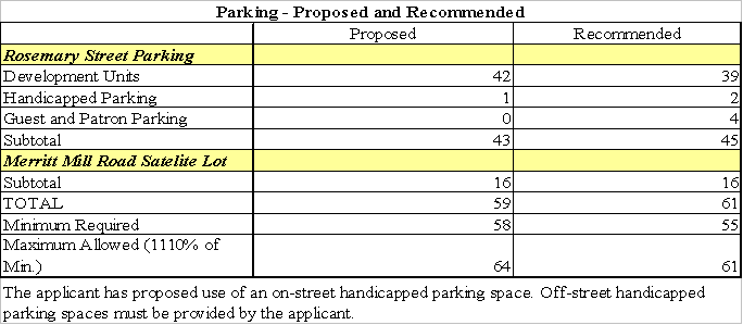
We recommend additional parking spaces because the applicant is proposing only enough parking for the dwelling units on the Rosemary Street portion of the site (42), while additional parking is located off-site (16). Even though this meets the requirements of the Development Ordinance, it will not adequately meet 1) handicapped parking requirements, 2) the removal of parking spaces for design reasons (see next paragraph), and 3) parking for residential guests and retail patrons. We recommend that 110% of the minimum required parking spaces be provided by the applicant, or a total of 61 parking spaces. We believe that this number of parking spaces would adequately serve the 39 dwelling units we recommend, 2 handicapped parking spaces, 4 parking spaces for guests and patrons, and 16 parking spaces in the Merritt Mill Road auxiliary parking lot, as summarized in the table below.
The applicant has proposed 3 parallel parking spaces south of units 27 through 33. We recommend that three of these proposed parallel parking spaces, adjacent to units 27 – 31, be removed to permit adequate space for vehicles to back out of the garages across the proposed drive aisle. We have included stipulations to this effect in Resolution A. We note that this may result in fewer parking spaces on site and would require approval of one of the parking compliance options noted above. Alternatively, the proposed number of dwelling units or commercial space could be reduced.
The applicant is proposing to locate 16 of the required parking spaces off-site at 109 Merritt Mill Road, which is approximately 1,650 feet walking distance from the West Rosemary Street site. The off-site parking provisions of the Development Ordinance require that off-site parking spaces be located within a 1,200-foot walking distance of a public entrance to the structure or land area containing the use for which such spaces are required. These proposed parking spaces do not meet the Development Ordinance provisions.
An alternative option for demonstration of compliance with parking requirements is Town Manager approval of a Transportation Management Plan. The applicant has submitted a Transportation Management Plan. We recommend that the Transportation Management Plan be revised to include this off-site parking lot for employees of the commercial space. We have included stipulations to this effect in Resolution A.
The applicant is proposing a single lane driveway for the gravel surfaced, off-site parking lot at 109 Merritt Mill Road. We believe that this driveway configuration could damage the critical root zone of a specimen Oak tree on the property frontage, that we recommend be protected (see Buffers and Landscaping Issues). We recommend that the applicant provide access to the parking lot from the Rogers property to the south, or from Merritt Mill Road with a driveway that straddles the southern property line. We recommend that the applicant enter into a cross-access agreement with the adjacent property owner to accomplish one of these two scenarios. We have included stipulations to this effect in Resolution A. If the applicant chooses to provide a driveway entrance on Merritt Mill Road, we recommend that a concrete apron be provided, built to Town standard, to minimize gravel from spilling into the street from the lot.
We recommend that the off-site parking lot at 109 Merritt Mill Road be completed prior to issuance of a Certificate of Occupancy for the mixed use part of the development proposal at West Rosemary Street and Mitchell Lane. The final design shall be approved by the Town Manager prior to issuance of a Zoning Compliance Permit. We have included a stipulation to this effect in Resolution A.
Bicycle Parking: The Town Council adopted a resolution on October 11, 2000, amending standards for bicycle parking facilities. For commercial and retail buildings, one bicycle parking space for every 10 automobile parking spaces is required. Twenty percent of these spaces must be Class I spaces and 80% must be Class II spaces as required by the resolution adopted by the Town Council[1]. For multi-family residential buildings, one bicycle parking space for every unit is required plus one space for every 10 automobile parking spaces is required. Ninety percent of these spaces must be Class I spaces and 10% must be Class II spaces. These standards are now part of the Town’s Design Manual, incorporated by reference into the Development Ordinance.
A total of 48 bicycle parking spaces are required by the Design Manual, for this proposal, to be comprised of 43 Class I spaces and 5 Class II spaces. The applicant is proposing to provide; 1) 29 Class II spaces distributed throughout the site in three wave-type bicycle racks, and 2) fulfilling the Class I spaces by the fact that tenants can store their personal bicycles in their dwelling units or garage enclosures. Therefore there would be space for a total of 72 bicycles on site, comprised of 29 Class II parking spaces and 43 storage spaces to meet the Class I requirement. We have included a stipulation to this effect in Resolution A.
Traffic Impact: The applicant has provided a Traffic Impact Analysis for this development prepared for the applicant by Martin, Alexiou, and Bryson. We note that the application has been revised from the previously proposed 48 units to the currently proposed 42 units. Therefore, the number of trips generated would presumably be less than those specified in the Traffic Impact Analysis. The analysis for 48 units concludes the following:
“Thomas Tucker proposes to build a mixed-use development along Rosemary Street in Chapel Hill, North Carolina. The development is scheduled to be completed by 2001 and will consist of a mixture of residential and commercial development. There are 48 townhomes and approximately 5,492 square feet of retail development proposed for the site.”
“The proposed development is located at the corner of Mitchell Lane and Rosemary Street (Figure 1). As shown in Figure 2, access to the site will be limited to two driveways along Mitchell Lane. In addition, the site is located along existing Chapel Hill Transit "A" Route, which runs along Rosemary Street and Mitchell Lane. Access to this route will be very convenient for residents and customers. Additional commercial and residential development is within easy walking distance, as well as additional Chapel Hill Transit routes.”
“Per the Town of Chapel Hill's requirements, the following intersections were analyzed for Existing and Future conditions:”
· “Rosemary Street and Mitchell Lane (unsignalized)”
· “Rosemary Street and Roberson Street (signalized)”
“Morning and afternoon peak hour capacity analyses were performed for the Existing and Future conditions for the above intersections. The transportation software used to analyze unsignalized and signalized intersections consisted of Synchro Professional and Highway Capacity Software (HCS).”
“The levels of service at all study area intersections are currently acceptable and are projected to operate acceptably with the development during the Build year (2001). Therefore, no improvements are proposed with the development.”
We believe that the applicant’s analysis concerning the impacts of this development on the level of service within the traffic study area is reasonable. We believe that the projected impact of 1,024 average daily trips (ADT) and 93 p.m. peak hour trips would justify requiring that the applicant provide two transportation improvements. If this application is approved, we recommend that the applicant provide the following improvements:
· $3,000 payment for the retiming of traffic signals at the Columbia / Rosemary Street intersection, the Church / Rosemary Street intersection, and the Roberson / Rosemary Street intersection, and
· Upgrade Columbia / Rosemary Street intersection including protected left turn traffic signal phasing and 12-inch signal heads for all signals.
The improvements at the Columbia / Rosemary Street intersection would be subject to the Town Manager’s and North Carolina Department of Transportation approval, prior to the issuance of a Zoning Compliance Permit. We have included stipulations to this effect in Resolution A.
Bus Stops: There is a Chapel Hill Transit bus stop (route ‘A’) near the intersection of Rosemary Street and Mitchell Lane. There are numerous other Chapel Hill Transit bus routes on Franklin Street that stop within walking distance of the proposed development. As of January 2, 2002 Chapel Hill Transit buses became fare free.
We note that there is not a bus route that runs the length of Rosemary Street at this time, however discussions have taken place about moving a bus route to Rosemary Street. We recommend that the applicant contribute $6,000 for potential bus-stop improvements, including a bench, trash can, information tube (for route maps), and a small shelter to be located on the Rosemary Street frontage of the site. If the funds are not used within 3 years of the date of Special Use Permit approval for said improvements, the applicant can request the funds be returned.. We have included a stipulation to this effect in Resolution A.
LANDSCAPING AND ARCHITECTURAL ISSUES
Buffers and Landscaping: The Development Ordinance requires landscape bufferyards around the perimeter of a portion of the mixed-use site. Landscape buffers are required on those portions of the site that are adjacent to the Residential-3 (R-3) zoning district. Those portions of the site that are in Town Center-2 (TC-2) or Town Center-2-Conditional (TC-2-C) and are adjacent to property also in TC-2 do not require landscape buffers. The table below indicates landscape buffers that are required by the Town’s Development Ordinance and those proposed by the applicant:
Bufferyard Summary
|
Bufferyard Location |
Bufferyard Required |
Bufferyard Proposed |
|
Northern Border between proposed TC-2-C and existing R-3 |
Min. 10 ft. Type ‘B’ Buffer |
10 ft. Type ‘B’ Buffer, with off-site enhancements1 |
|
Western, Southern and Eastern Borders between TC-2 to TC-2 |
No Buffers required |
Some landscaping along Rosemary St. & Mitchell Lane frontages, as well as two 20 ft. segments of western property line. |
1. Ten-foot wide off-site landscape and grading easement is proposed with 6-foot high wooden fence and an additional 10-foot wide landscaped bufferyard, beginning at the northwestern most corner of the site, running approximately 250 linear feet to the east, north-east.
We believe that this application meets the Development Ordinance requirements for landscape bufferyards.
The applicant is proposing to clear and regrade most of the site. There are three specimen trees on the site including one 36-inch Sycamore and two 24-inch Oaks. The applicant is proposing to remove the 36-inch Sycamore tree and retain the oaks. We do not believe the applicant can reasonably be required to preserve the Sycamore tree, given its central location on the site.
The applicant has proposed a 10-foot type ‘B’ bufferyard along the northern property line where the proposed Town Center-2-Conditional (TC-2-C) zoning district is adjacent to the Residential-3 (R-3) zoning district. The applicant is proposing to supplement the landscape bufferyard with an additional 6-foot high wooden fence and a 10-foot planting easement located on the adjacent property. The off-site buffer is proposed to be placed in a 10-foot wide off-site landscape and grading easement. We recommend that the applicant provide a landscape and grading easement agreement, to be approved by the Town Manager, prior to issuance of a Zoning Compliance Permit. We have included stipulations to this effect in Resolution A.
The applicant is proposing to install 12 street trees (2.5 inch caliper “golden rain tree”) in engineered planting vaults within the proposed 4-foot amenity strip between the sidewalk and back of curb. We recommend that a least two different species of street trees be planted. We have included a stipulation to this effect in Resolution A. In addition, as noted earlier, we recommend a 6-foot wide amenity strip and tree grates on Rosemary Street and 5-foot amenity strip and tree grates on Mitchell Lane. We believe the wider amenity strip will help to minimize tree damage from opening car doors along the street (see Access and Circulation Issues).
We recommend that the applicant develop an encroachment agreement with the Town providing that the applicant will be responsible for long-term maintenance of the proposed street trees and vaults, subject to Town Manager approval, prior to issuance of a Zoning Compliance Permit. We have included a stipulation to this effect in Resolution A.
As noted earlier, we recommend that the applicant expand the Rosemary Street setback for the westernmost three or four units by shifting the building footprints an additional 4’ – 6’ farther north. In this area and elsewhere, where additional open space is available adjacent to the public sidewalk, we recommend that planters and site furnishings be included (see Access and Circulation Issues). We have included a stipulation to this effect in Resolution A.
We recommend that an underground drainage system, connected to the storm drainage system, be provided for the area beneath the tree vaults and amenity strip. We have included a stipulation to this effect in Resolution A.
Regarding the proposed off-site parking lot, two 30-inch specimen Oak trees are located on the site. We recommend that the applicant prepare a Landscape Protection Plan for the off-site parking lot at 109 Merritt Mill Road. We recommend that the applicant preserve the two 30-inch Oak trees along Merritt Mill Road. We recommend that a low fence or wall be installed to screen the Merritt Mill Road parking lot from the street rather than providing additional planted screening. Due to root competition from the large oaks at the front of the lot, we believe that new plantings may not prosper in this area. We have included stipulations to this effect in Resolution A.
The applicant is proposing a single lane driveway for the gravel surfaced, off-site parking lot at 109 Merritt Mill Road. We believe that this driveway could damage the critical root zone of a specimen Oak tree on the property frontage that we recommend be protected (see Access and Circulation Issues). As noted earlier, we recommend that the applicant provide access to the parking lot from the Orange Lodge to the north, the Rogers property to the south, or from Merritt Mill Road with a driveway that straddles the southern property line. We recommend that the applicant enter into a cross-access agreement with one of the two adjacent property owners to accomplish one of these scenarios. We have included stipulations to this effect in Resolution A.
Building Elevations: We recommend that detailed building elevations be approved by the Community Design Commission, prior to the issuance of a Zoning Compliance Permit. We have included a stipulation to this effect in Resolution A.
We recommend that the applicant identify the building envelope with building elevations (primary and secondary height limits) permitted by Sections 13.9 and 13.11.1 of the Development Ordinance in the Town Center-2 (TC-2) zoning district to illustrate compliance with building height restrictions prior to the issuance of a Zoning Compliance Permit. We have included a stipulation to this effect in Resolution A.
Lighting Plan: We recommend that a detailed lighting plan be approved by the Community Design Commission, prior to the issuance of a Zoning Compliance Permit. We have included a stipulation to this effect in Resolution A. We note that particular attention to lighting will be necessary because of the adjacent residential district, including the residence at 207 Mitchell Lane.
We recommend that the lighting plan specifically address public sidewalk and interior walkway lighting. We recommend that building mounted downlit fixtures be provided. We believe these fixtures would provide the necessary lighting levels for these pedestrian areas while minimizing glare into the upper level residential units. We have included a stipulation to this effect in Resolution A.
ENVIRONMENTAL ISSUES
Watershed Protection District: The development is not located in the Watershed Protection District.
Resource Conservation District: The development is not located in the Resource Conservation District.
Stormwater Management: Approximately 83.1% of the proposed Rosemary Street is proposed to be impervious surface. If this application is approved, we recommend that the applicant provide information regarding the capacity and condition of the downstream stormwater conveyance system prior to the issuance of a Zoning Compliance Permit. We note that if the existing downstream conveyance system cannot accommodate runoff from the proposed development, we recommend that the applicant be required to improve off-site stormwater drainage facilities to mitigate this impact. We have included a stipulation to this effect in Resolution A.
We have included our standard stipulation in Resolution A, requiring Town Manager approval of a Stormwater Management Plan and to provide an engineered stormwater facility. If this application is approved, we recommend that the Stormwater Management Plan be approved prior to the issuance of a Zoning Compliance Permit. The facility design shall be based on the 1-year and 50-year frequency, 24-hour duration storms, where the post-development stormwater run-off rate shall not exceed the pre-development rate. The engineered stormwater facility shall also be designed to remove 85% total suspended solids and treat the first inch of precipitation.
Stormwater Best Management Practices: The applicant has proposed an underground physical treatment system with a sand matrix for detention and water quality enhancement. We believe that the proposed Best Management Practice (BMP) would be important given the high percentage of impervious surface proposed. We recommend that prior to the issuance of a Zoning Compliance Permit the proposed Best Management Practice be approved by the Town Manager as part of the Stormwater Management Plan. We have included a stipulation to this effect in Resolution A.
A number of Best Management Practices (BMP’s) are suitable mechanisms for water quality treatment for particular developments as long as they are selected from an approved menu of choices, such as the North Carolina Division of Water Quality Stormwater Best Management Practices Manual.
Stormwater Operations and Management Plan: We recommend that the applicant provide a Stormwater Operations and Maintenance Plan for all engineered stormwater facilities. We recommend that the plan include the owner's financial responsibility and include a maintenance schedule for the facilities, to ensure that it continues to function as originally intended, to be approved by the Town Manager. We have included a stipulation to this effect in Resolution A.
Stormwater Drainageway Easement: We recommend that the applicant provide stormwater drainageway easements on-site (and off-site, if off-site facilities are necessary) for stormwater facilities in accordance with Town guidelines, to be approved by the Town Manager. In addition, we recommend that notes be included on the Stormwater Management Plan and easement plat that provide for periodic maintenance of stormwater facilities. We have included stipulations to this effect in Resolution A.
Erosion Control: We recommend that an Erosion Control Plan for the site be approved by the Orange County Erosion Control Officer, and be submitted to the Town Manager prior to issuance of a Zoning Compliance Permit. We have included a stipulation to this effect in Resolution A.
RECREATION REQUIREMENTS
Recreation: The applicant is required to provide 5,050 square feet of recreation space. The applicant is proposing providing a payment-in-lieu for required recreation space, as provided in Section 13.7.10 of the Development Ordinance. We have included a stipulation to this effect in Resolution A. We note that this provision is a discretionary Council action. The Council may accept a payment-in-lieu of recreation space but is under no obligation to do so. The amount of the payment shall be determined by the provisions set forth in Section 13.7.10 of the Development Ordinance, as follows:
“The amount of the payment shall be the product of the minimum amount of recreational space required multiplied by the fair market value of the land being developed. The fair market value of the land being developed (including streets, utilities, and other related improvements) shall be the expected fair market value of the land after it is developed in the manner proposed by the developer and approved by the Town. The cost associated with appraisal of the fair market value of the land shall be borne by the developer.”
The Parks and Recreation Commission reviewed this application on April 10, 2002 and voted 7 to 0 to recommended approval of the application. A summary is attached.
UTILITY AND SERVICE ISSUES
Utilities: We recommend that detailed utility plans be reviewed and approved by OWASA, Duke Power Company, BellSouth, Public Service Company, Time Warner Cable, and the Town Manager prior to issuance of a Zoning Compliance Permit. We have included a stipulation to this effect in Resolution A.
We recommend that all utility lines, other than 3-phase electric power distribution lines, be placed underground and be indicated on final plans. We have included a stipulation to this effect in Resolution A.
Fire Safety: We believe that the proposed access and circulation pattern is adequate to provide sufficient space for the movement of emergency vehicles. We recommend that adequate turning radii be provided for Town emergency vehicles and that turning radius templates are shown on final plans prior to issuance of Zoning Compliance Permit. We have included a stipulation to this effect in Resolution A.
We have included our standard stipulation in Resolution A requiring that a fire flow report that demonstrates compliance with Town Standards, sealed by a professional engineer, be submitted for review and approval by the Town Manager prior to the issuance of a Zoning Compliance Permit.
We recommend that the buildings have sprinkler systems in accordance with provisions of the Town Code, to be reviewed and approved by the Town Manager prior to the issuance of a Zoning Compliance Permit. We have included a stipulation to this effect in Resolution A.
We note that it is Town Policy that all structures must be located within 500 feet of a fire hydrant. In addition, we note that the Town seeks to maintain a 50-foot maximum distance between fire hydrants and fire department connections, in a clearly visible and accessible location on the street side of buildings. We have included stipulations to this effect in Resolution A.
Refuse Management and Recycling: The applicant proposes to provide Town refuse and recycling facilities near the western property line at the end of the northern drive aisle. We believe the proposed refuse and recycling facilities are appropriately sited and adequately designed. We recommend that adequate turning radii be provided for Town vehicles to service refuse facilities and that turning radius templates are shown on final plans prior to issuance of Zoning Compliance Permit. We have included a stipulation to this effect in Resolution A.
We recommend that heavy-duty paving be used in the drive aisle for service vehicles to be approved by the Town Manager prior to the issuance of a Zoning Compliance Permit. We have included a stipulation to this effect in Resolution A.
We recommend that the applicant contact the Orange County Solid Waste staff to discuss the relocation or deconstruction of the existing structures. We have included our standard stipulation in Resolution A regarding approval of a Solid Waste Management Plan.
OTHER ISSUES
Recombination Plat: We recommend that a recorded recombination plat be provided prior to the issuance of a Zoning Compliance Permit. We have included a stipulation to this effect in Resolution A.
Miscellaneous: We have also included a stipulation in Resolution A requiring that no open burning associated with this development shall be permitted.
SUMMARY
Special Use Permit Modification Findings: For approval of a Special Use Permit, the Council must make the following findings, as set forth in Section 18.2 of the Development Ordinance:
(a) That the use or development is located, designed, and proposed to be operated so as to maintain or promote the public health, safety, and general welfare.
(b) That the use or development complies with all required regulations and standards of this chapter, including all applicable provisions of Articles 12, 13, and 14 and with all other applicable regulations.
(c) That the use or development is located, designed, and proposed to be operated so as to maintain or enhance the value of contiguous property, or that the use or development is a public necessity;
(d) That the use or development conforms to the general plans for the physical development of the Town as embodied in this chapter and in the Comprehensive Plan.
Upon review of the application and information that has been submitted to date, our preliminary recommendation is that these findings can be made provided
CONCLUSION
Based on information available at this stage of the application review process, we believe that the proposal, with the conditions in Resolution A, meet the requirements of the applicable sections of the Development Ordinance and Design Manual, and that the proposal fulfills the purposes of the Comprehensive Plan. We note that this conclusion is based on rezoning of a portion of the site from Residential-3 (R-3) to Town Center-2-Conditional (TC-2-C).
Resolutions A, B, C, D, E, and F would approve the application with conditions.
Resolution G would deny the application.
Project Fact Sheet Requirements
Check List of Regulations and Standards
Special Use Permit Application
|
ROSEMARY MIXED-USE DEVELOPMENT |
STAFF EVALUATION* |
|
|
|
Compliance |
Non-Compliance |
|
Use Permitted |
Ö (with rezoning approval) |
Ö (without rezoning approval) |
|
Min. Gross Land Area |
Ö |
|
|
Min. Lot Width |
Ö |
|
|
Max. Floor Area |
Ö |
|
|
Min. Outdoor Space |
Ö |
|
|
Min. Livability Space |
Ö |
|
|
Min. Recreation Space |
Ö (with payment-in-lieu) |
Ö (without payment-in-lieu) |
|
Impervious Surface Limits |
N/A |
|
|
Min. # Parking Spaces |
Ö |
|
|
Min. # Loading Spaces |
N/A |
|
|
Min. # Handicap Spaces |
|
Ö |
|
Max. # Dwelling Units |
N/A |
|
|
Min. Street Setback |
Ö |
|
|
Min. Interior Setback |
Ö |
|
|
Min. Solar Setback |
Ö |
|
|
Max. Height Limit |
Ö |
|
|
Min. Landscape Buffers |
Ö |
|
|
Public Water and Sewer |
Ö |
|
N/A = Not Applicable Prepared: June 11, 2002
RESOLUTION A
(Manager’s Preliminary Recommendation)
A RESOLUTION APPROVING AN APPLICATION FOR A SPECIAL USE PERMIT FOR ROSEMARY STREET MIXED-USE DEVELOPMENT
BE IT RESOLVED by the Council of the Town of Chapel Hill that it finds that the Special Use Permit application proposed by Thomas Tucker, on property identified as Chapel Hill Township Tax Map 85, Block A, Lots 5-9 and Chapel Hill Township Tax Map 92, Block E, Lot 27 (PIN Nos. 9788163854, 9788163767, 9788163751, 9788163708, 9788163759, and 9788058608), if developed according to the site plan dated 3/1/02 and conditions listed below, would:
1. Be located, designed, and proposed to be operated so as to maintain or promote the public health, safety, and general welfare;
2. Comply with all required regulations and standards of the Development Ordinance, including all applicable provisions of Articles 12, 13, and 14, and with all other applicable regulations;
3. Be located, designed, and proposed to be operated so as to maintain or enhance the value of contiguous property; and
4. Conform with the general plans for the physical development of the Town as embodied in the Development Ordinance and in the Comprehensive Plan.
BE IT FURTHER RESOLVED that the Town Council hereby approves the application for a Special Use Permit for Rosemary Street Mixed-Use Development in accordance with the plans listed above and with the conditions listed below:
Stipulations Specific to the Development
1. That construction begin by ________________ (two years from the date of Council approval) and be completed by ____________ (three years from the date of Council approval).
2. Land Use Intensity: This Special Use Permit authorizes construction of a mixed-use development consisting of a total of 53,856 square feet of floor area, specified as follows on the property identified as Chapel Hill Township Tax Map 85, Block A, Lots 5-9 (PIN Nos. 9788163854, 9788163767, 9788163751, 9788163708, and 9788163759):
Total # of Buildings: 5
 Maximum Floor Area Total: 53,856
s.f.
Maximum Floor Area Total: 53,856
s.f.
Maximum # of Dwelling Units: 39
Maximum General Business or Convenience Business Use: 6,204 s.f. Maximum # of Off-Street Parking Spaces: 45
Minimum # of Bicycle Parking Spaces: 72 (29 in racks outside)
Minimum Outdoor Space (s.f.): 40,575 s.f.
Minimum Livability Space (s.f.): 24,784 s.f.
This Special Use Permit authorizes construction of an off-site parking lot, consisting of no more than 16 parking spaces, on the property identified as Chapel Hill Township Tax Map 92, Block E, Lot 27 (PIN #9788058608) at 109 Merritt Mill Road, specified as follows:
Maximum # of Off-Street Parking Spaces: 16
Stipulations Related to Required Improvements
3. One-Way Internal Drive Aisle Exit: That the southern, one-way internal drive aisle, on the mixed-use portion of the development, shall be narrowed to a to 15 or 16 feet width, back of curb to back of curb, subject to Town Manager approval, prior to issuance of a Zoning Compliance Permit.
4. Stub-Out to Burnett Property: That a vehicular stub-out shall be provided to the adjacent Burnette property to the west, subject to Town Manager approval, prior to issuance of a Zoning Compliance Permit.
5. Cross-Access Easement: That a cross-access easement shall be recorded on a plat to facilitate future cross-access through the applicant’s mixed-use portion of the development to the adjacent Burnett Property, subject to Town Manager approval, prior to issuance of a Zoning Compliance Permit.
6. Rosemary Street Frontage Improvements: That the applicant shall provide a 6-foot wide concrete sidewalk, 6-foot wide amenity strip and 30-inch wide curb and gutter built to Town standards on the property’s Rosemary Street frontage in dedicated public right-of-way. That the applicant shall expand the Rosemary Street setback for the westernmost three or four units by shifting the building footprints an additional 4 to 6 feet further north. The final design subject to Town Manager approval, prior to issuance of a Zoning Compliance Permit.
7. Rosemary Street Right-Of-Way Dedication: That the applicant shall provide a recorded plat that dedicates public right-of-way for the 6-foot wide sidewalk, 6-foot wide planting strip and 30-inch wide curb and gutter, and additional street width, as specified in stipulation #6, subject to Town Manager approval, prior to issuance of a Zoning Compliance Permit.
8. Other Street Frontage Improvements: That the applicant shall provide planters and site furnishings where open space is available adjacent to the public sidewalk on Rosemary Street and Mitchell Lane, subject to Town Manager approval, prior to issuance of a Zoning Compliance Permit.
9. Amenity Strip Improvements: That the applicant shall provide Town standard benches, trash receptacles and bike racks in the amenity strip areas on Rosemary Street and Mitchell Lane subject to Town Manager approval, prior to issuance of a Zoning Compliance Permit.
10. Bus-Stop Improvements Payment: That the applicant shall contribute $6,000 to the Town for potential bus-stop improvements, including a bench, trash can, information tube (for route maps), and a small shelter to be located on the Rosemary Street frontage of the site. Design subject to approval by the Town Manager. If the funds are not used within 3 years of the date of Special Use Permit approval for said improvements, the applicant can request the funds be returned.
11. Mitchell Lane Frontage Improvements: That the applicant shall provide a 5-foot wide concrete sidewalk, 5-foot wide amenity strip and 30-inch wide curb and gutter built to Town standards on the property’s Mitchell Lane frontage. The applicant shall construct a 5-foot sidewalk only, without the amenity strip, north of the northernmost access on Mitchell Lane, to minimize the impact on the nearby large oak tree. The final design subject to Town Manager approval, prior to issuance of a Zoning Compliance Permit.
12. Mitchell Lane Right-Of-Way Dedication: That the applicant shall provide a recorded plat that dedicates public right-of-way for the 5-foot wide sidewalk, 5-foot wide planting strip and 30-inch wide curb and gutter subject to Town Manager approval, prior to issuance of a Zoning Compliance Permit.
13. Street Frontage Encroachment Agreement: That the applicant shall enter into an encroachment agreement with the Town for the balconies, lighting fixtures, or other above ground elements that are proposed to extend over the dedicated right-of-way. The encroachment agreement subject to Town Manager approval, prior to issuance of a Zoning Compliance Permit.
14. Internal Sidewalks: That sidewalks internal to the site, built to Town standard, shall have a minimum width of 4 feet. The final design shall be subject to Town Manager approval, prior to issuance of a Zoning Compliance Permit.
15. Passageway Width: That the width of the passageway between the building fronting on Rosemary Street and the building immediately north of it shall be increased to greater than 10 feet, to the extent feasible, subject to approval by the Town Manager prior to the issuance of a Zoning Compliance Permit.
16. Western Sidewalk Connection to Rosemary Street: That the applicant shall provide a 4-foot wide pedestrian sidewalk connection to Rosemary Street, built to Town standard with additional landscaping, between the western property line and the westernmost units. The final design shall be subject to Town Manager approval, prior to issuance of a Zoning Compliance Permit.
17. Merritt Mill Road Right-Of-Way: That the applicant shall provide a recorded plat that dedicates one half of a 50-foot public right-of-way subject to Town Manager approval, prior to issuance of a Zoning Compliance Permit.
18. Merritt Mill Road Off-site Parking Lot Completion: That the off-site parking lot at 109 Merritt Mill Road be completed prior to issuance of a Certificate of Occupancy for the mixed use part of the development proposal at West Rosemary Street and Mitchell Lane. The final design subject to Town Manager approval, prior to issuance of a Zoning Compliance Permit.
19. Merritt Mill Road Parking Lot Cross-Access Agreement: That the applicant shall provide access to the parking lot from the Rogers property to the south, or from Merritt Mill Road with a driveway that straddles the southern property line. That the applicant shall enter into a cross-access agreement with the adjacent property owner to accomplish one of these two scenarios. The final design subject to Town Manager approval, prior to issuance of a Zoning Compliance Permit.
20. Transportation Management Plan: That the applicant shall provide a Transportation Management Plan subject to approval by the Town Manager prior to issuance of a Zoning Compliance Permit. The Transportation Management Plan shall include:
· A maximum of 45 parking spaces on the mixed-use portion of the site, including 2 handicapped spaces;
· A maximum of 16 parking spaces at the Merritt Mill Road off-site parking lot for employees of the business/ convenience business uses;
· Provision for designation of a Transportation Coordinator;
· Provisions for an annual Transportation Survey and Annual Report to the Town Manager;
· Quantifiable traffic reduction goals and objectives;
· Ridesharing incentives;
· Public transit incentives; and
· Other measures subject to approval by the Town Manager.
21. Handicapped Parking Spaces: That no less than two handicapped parking spaces shall be located at the Rosemary Street site and meet the minimum Town and State Building Code dimensional requirements.
22. Parking Space Elimination: That the applicant shall eliminate 3 proposed parallel parking spaces, adjacent to units 27 – 31, subject to Town Manager approval, prior to issuance of a Zoning Compliance Permit.
23. Bicycle Parking: That the applicant shall provide a total of 72 covered bicycle parking spaces; 43 bicycle spaces shall be designed to Class I standards and 29 bicycle spaces shall be designed to Class II standards according to the Town Design Manual, subject to Town Manager approval, prior to issuance of a Zoning Compliance Permit.
24. Signal Retiming: That the applicant shall provide a $3,000 payment to retime traffic signals at the Columbia / Rosemary Street intersection, the Church / Rosemary Street intersection, and the Roberson / Rosemary Street intersection, prior to issuance of a Zoning Compliance Permit.
25. Intersection Improvements: That the applicant will provide a payment, proportional to traffic impact (payment shall not exceed $15,000) to improve the Columbia / Rosemary Street intersection with protected left turn traffic signal phasing and 12-inch signal heads, subject to Town Manager approval, prior to issuance of a Zoning Compliance Permit.
26. Payment-In-Lieu for Recreation Space: That the applicant shall provide a payment-in-lieu of the required 5,050 square feet of recreation space, to be calculated according to Section 13.7.10 of the Development Ordinance, subject to Town Manager approval, prior to issuance of a Zoning Compliance Permit. That funds shall be used entirely for Hargraves Park recreation projects.
27. Provision of Affordable Housing: That the applicant shall provide 15% (6) affordable rental dwelling units on-site that are vary in size from 800 to 1,400 square feet. The units shall be located throughout the development, dispersed among the market units, and shall reflect the size distribution of the market units.
28. Affordable Housing Eligibility: That eligible renters for affordable dwelling units shall include families earning 80% or less of median 3-person family income for the Raleigh-Durham-Chapel Metropolitan Statistical Area (MSA). Section 8 vouchers will be accepted for these units.
29. Affordable Housing Rental Rates: Rental rates shall not exceed current Section 8 Fair Market rents (including utilities) as published by the U.S. Department of Housing and Urban Development, according to the number of bedrooms in each unit (e.g. 2002 rate: 2 bedroom unit, $777/month).
30. Affordable Housing Marketing: That the owner and management company enter into a “good faith” marketing agreement to ensure that the affordable units are rented to eligible low-income renters. The owner shall work with local non-profit low income housing organizations to advertise affordable units and recruit eligible renters.
31. Affordable Housing-Rental Unit Exception: The recorded deed restrictions shall include a provision that if after working with local non-profits, owner/management company are unable to recruit eligible renters, they may rent such units to other renters without restrictions for up to 12 months, if written authorization is provided in advance for such rental units from Orange Community Housing and Land Trust and approved the Town of Chapel Hill.
32. Affordable Housing Maintenance of Affordability Over Time: That the applicant shall record deed restrictions to ensure that the affordable units remain affordable in perpetuity to low income tenants, to be approved by the Town Manager and the Orange Community Housing and Land Trust, prior to the issuance of a Zoning Compliance Permit.
33. Completion of Affordable Housing: That no Certificates of Occupancy shall be issued for any units in the development until all required affordable units are available for occupancy.
Stipulations Related to Landscape Elements
34. Landscape Plan Approval: That a detailed Landscape Plan and Landscape Maintenance Plan shall be prepared for the site including the plantings proposed in the public right-of-way. The plan shall be subject to Town Manager approval, prior to issuance of a Zoning Compliance Permit.
35. Landscape Protection Plan: That a detailed Landscape Protection Plan be prepared, clearly indicating which rare and specimen trees will be removed and preserved and including Town standard landscaping protection notes. The plan shall be subject to Town Manager approval, prior to issuance of a Zoning Compliance Permit.
36. Street Trees: That applicant shall provide a recorded encroachment agreement with the Town providing that the applicant will be responsible for long-term maintenance of the proposed street trees and vaults, subject to Town Manager approval, prior to issuance of a Zoning Compliance Permit.
37. Tree Preservation in Mixed-Use Portion of Development: That the applicant preserve the two 24-inch Oak trees located along the northern property line, adjacent to 207 Mitchell Lane. That the applicant shall indicate the critical root zones on plans, provide tree protection fencing, and not perform any land disturbing activity in the trees’ critical root zone areas.
38. Landscape Buffers in Mixed-Use Portion of Development: That the applicant provide the following landscape buffers:
Bufferyard Summary
|
Bufferyard Location |
Bufferyard |
|
Northern Border between proposed TC-2-C and existing R-3 |
10 ft. Type ‘B’ Buffer, with off-site enhancements* |
|
Western, Southern and Eastern Borders between TC-2 to TC-2 |
Landscaping along Rosemary St. & Mitchell Lane frontages, as well as two 20 ft. segments of western property line, as identified on the approved plans. |
*Ten-foot wide off-site landscape and grading easement to be provided with 6-foot high wooden fence and a 10-foot wide landscaped bufferyard on-site, beginning at the northwestern most corner of the site, running approximately 250 linear feet to the east, north-east.
This approval does not authorize alternative buffers. The off-site landscape easement shall be approved by the Town Manager and recorded at the Orange County Register of Deeds Office prior to the issuance of a Zoning Compliance Permit.
39. Off-site Parking Lot Landscape Protection Plan: That the applicant shall prepare a Landscape Protection Plan for the off-site parking lot at 109 Merritt Mill Road subject to approval by the Town Manager prior to issuance of a Zoning Compliance Permit.
40. Off-site Parking Lot Tree Preservation: That the applicant shall preserve the two 30-inch Oak trees along the frontage at the off-site parking lot at 109 Merritt Mill Road.
41. Off-site Parking Lot Landscape Requirements: That the applicant shall meet parking lot landscape screening requirements at 109 Merritt Mill Road as specified in Article 14 of the Development Ordinance by installing a low fence or wall along Merritt Mill Road rather than providing additional planted screening The final design shall be subject to approval by the Town Manager prior to issuance of a Zoning Compliance Permit.
Stipulations Related to Utilities
42. Utility/Lighting Plan Approval: That the final utility/lighting plan be approved by Orange Water and Sewer Authority (OWASA), Duke Power Company, BellSouth, Public Service Company, Time/Warner Cable and the Town Manager before issuance of a Zoning Compliance Permit.
43. Utility Lines: That all utility lines, other than 3-phase electric power distribution lines, shall be underground and shall be indicated on final plans.
Stipulations Related to Fire Protection/Fire Safety
44. Fire Flow: That a fire flow report shall be prepared by a registered professional engineer, showing that flows meet the minimum requirements of the Design Manual, shall be subject to approval by the Town Manager prior to issuance of a Zoning Compliance Permit.
45. Sprinkler System: That the buildings shall have sprinkler systems in accordance with Town Code, shall be subject to approval by the Town Manager prior to issuance of a Zoning Compliance Permit.
46. Fire Hydrant Location: That all new structures shall be located within 500 feet of a fire hydrant, shall be subject to approval by the Town Manager prior to issuance of a Zoning Compliance Permit.
47. Fire Department Connections: That fire department connections shall be no more than 50 feet from the hydrants and located on street side of buildings in visible, accessible locations, subject to Town Fire Marshall approval.
Stipulations Related to Refuse and Recycling Collection
48. Solid Waste Management Plan: That a Solid Waste Management Plan, including provisions for recycling and for the management and minimizing of construction debris, shall be subject to approval by the Town Manager prior to issuance of a Zoning Compliance Permit.
49. Solid Waste and Recycling Facilities: That the applicant shall site solid waste and recycling facilities near the end of the western end northern drive aisle at the along the property line adjacent to the Burnette property, shall be subject to approval by the Town Manager prior to issuance of a Zoning Compliance Permit.
50. Vertical Clearances: That the applicant shall clearly specify vertical “tunnel” clearances over driveways to provide for safe refuse and emergency vehicle circulation, shall be subject to approval by the Town Manager prior to issuance of a Zoning Compliance Permit.
51. Pre-construction Conference: That the applicant shall hold a pre-construction conference with Orange County Solid Waste staff prior to any construction activity on the site. A note indicating such shall be included on final plans.
Miscellaneous Stipulations
52. Building Envelope Identification: That the applicant shall comply with Town height and setback regulations. The Final Plans shall identify the building envelope with building elevations (primary and secondary height limits) permitted by Sections 13.9 and 13.11.1 of the Development Ordinance in the Town Center-2 (TC-2) zoning district, prior to the issuance of a Zoning Compliance Permit.
53. Recorded Recombination Plat: That a recorded recombination plat, subject to Town Manager approval, shall be provided prior to the issuance of a Zoning Compliance Permit.
54. Community Design Commission Approval: That the Community Design Commission shall approve the building elevations and the lighting plan for the both portions of the development, prior to the issuance of a Zoning Compliance Permit.
55. Stormwater Management Plan: That a Stormwater Management Plan shall be approved by the Town Manager prior to issuance of a Zoning Compliance Permit. The facility design shall be based on the 1-year and 50-year frequency, 24-hour duration storms, where the post-development stormwater run-off rate shall not exceed the pre-development rate. The engineered stormwater facility shall also be designed to remove 85% total suspended solids and treat the first inch of precipitation.
56. Stormwater Best Management Practices: That the applicant shall provide a Best Management Practice for detention and water quality enhancement, such as an underground physical treatment system with a sand or gravel matrix, or alternative system, shall be subject to approval by the Town Manager prior to issuance of a Zoning Compliance Permit.
57. Stormwater Operations and Management Plan: That the applicant shall provide a Stormwater Operations and Maintenance Plan for all engineered stormwater facilities. That the plan shall include the owner's financial responsibility and include the maintenance schedule of the facilities to ensure that it continues to function as originally intended and shall be approved by the Town Manager.
58. Off-site Stormwater Conveyance: That the applicant shall provide information regarding the capacity and condition of the downstream stormwater conveyance system. That the applicant shall be required to improve off-site stormwater drainage facilities to mitigate this impact if the existing downstream conveyance system cannot accommodate runoff from the proposed development and shall be subject to approval by the Town Manager prior to issuance of a Zoning Compliance Permit.
59. Stormwater Drainageway Easement: That all on-site stormwater facilities shall be located within a stormwater drainageway easement as required by the Town Manager.
60. Certificates of Occupancy: That no Certificates of Occupancy shall be issued until all required public improvements are complete, and that a note to this effect shall be placed on the final plat.
That if the Town Manager approves a phasing plan, no Certificates of Occupancy shall be issued for a phase until all required public improvements for that phase are complete; no Building Permits for any phase shall be issued until all public improvements required in previous phases are completed to a point adjacent to the new phase, and that a note to this effect shall be placed on the final plat.
61. Detailed Plans: That the final detailed site plan, grading plan, utility/lighting plans, stormwater management plan (with hydraulic calculations), and landscape plans shall be approved by the Town Manager prior to issuance of a Zoning Compliance Permit, and that such plans shall conform to the plans approved by this application and demonstrate compliance with all applicable conditions and design standards of the Development Ordinance and Design Manual.
62. Erosion Control: That a soil erosion and sedimentation control plan, including provisions for maintenance of facilities and modification of the plan if necessary, shall be approved by the Orange County Erosion Control Officer, and that a copy of the approval be provided to the Town Manager prior to the issuance of a Zoning Compliance Permit.
63. Open Burning: That no open burning shall be permitted during the construction of this development.
64. Silt Control: That the applicant shall take appropriate measures to prevent and remove the deposit of wet or dry silt on adjacent paved roadways.
65. Construction Sign Required: That the applicant shall post a construction sign that lists the property owner’s representative, with a telephone number; the contractor’s representative, with a telephone number; and a telephone number for regulatory information at the time of issuance of a Zoning Compliance Permit. The construction sign may have a maximum of 32 square feet of display area and may not exceed 8 feet in height. The sign shall be non-illuminated, and shall consist of light letters on a dark background.
66. Continued Validity: That continued validity and effectiveness of this approval is expressly conditioned on the continued compliance with the plans and conditions listed above.
67. Non-severability: That if any of the above conditions is held to be invalid, approval in its entirety shall be void.
NOW, THEREFORE, BE IT RESOLVED by the Council of the Town of Chapel Hill that the Council hereby approves the application for a Special Use Permit for ROSEMARY STREET MIXED-USE DEVELOPMENT.
This the _________ day of _______________, 2002.
RESOLUTION B
(Planning Board Recommendation)
A RESOLUTION APPROVING AN APPLICATION FOR A SPECIAL USE PERMIT FOR ROSEMARY STREET MIXED-USE DEVELOPMENT
BE IT RESOLVED by the Council of the Town of Chapel Hill that it finds that the Special Use Permit application proposed by Thomas Tucker, on property identified as Chapel Hill Township Tax Map 85, Block A, Lots 5-9 and Chapel Hill Township Tax Map 92, Block E, Lot 27 (PIN Nos. 9788163854, 9788163767, 9788163751, 9788163708, 9788163759, and 9788058608), if developed according to the site plan dated 3/1/02 and conditions listed below, would:
1. Be located, designed, and proposed to be operated so as to maintain or promote the public health, safety, and general welfare;
2. Comply with all required regulations and standards of the Development Ordinance, including all applicable provisions of Articles 12, 13, and 14, and with all other applicable regulations;
3. Be located, designed, and proposed to be operated so as to maintain or enhance the value of contiguous property; and
4. Conform with the general plans for the physical development of the Town as embodied in the Development Ordinance and in the Comprehensive Plan.
BE IT FURTHER RESOLVED that the Town Council hereby approves the application for a Special Use Permit for Rosemary Street Mixed-Use Development in accordance with the plans listed above and with the conditions listed below:
1. Resolution A: That all of the stipulations in Resolution A shall apply to the proposed development, unless modified or superseded by those stipulations below.
That the following Stipulations in Resolution A shall be revised:
2. Passageway Width: That the passageway between the building fronting on Rosemary Street and the building immediately north of it be increased to a minimum of 14 feet wide, rather than 10 feet. Accordingly, Stipulation #15 of Resolution A shall be revised as follows:
· “Passageway Width: That the width of the passageway between the building fronting on Rosemary Street and the building immediately north of it shall be increased to a minimum of 14 feet, to be approved by the Town Manager.”
3. Signal Retiming: That the signal retiming payment be proportional to the projected impact (payment shall not exceed $3,000) generated by traffic from the proposed development at the specified intersection, rather than the full amount. Accordingly, Stipulation #24 of Resolution A shall be revised as follows:
· “Signal Retiming: That the applicant shall provide a payment to retime traffic signals at the Columbia / Rosemary Street intersection, the Church / Rosemary Street intersection, and the Roberson / Rosemary Street intersection, proportional to the traffic impact, and shall not exceed $3000, prior to issuance of a Zoning Compliance Permit.”
4. Payment-In-Lieu for Recreation Space: That the payment-in-lieu funds for recreation not be used exclusively for Hargraves Park recreation projects. Accordingly, Stipulation #26 of Resolution A shall be revised as follows:
· “Payment-In-Lieu for Recreation Space: That the applicant shall provide a payment-in-lieu of the required 5,050 square feet of recreation space, to be calculated according to Section 13.7.10 of the Development Ordinance, subject to Town Manager approval, prior to issuance of a Zoning Compliance Permit.”
5. Provision of Affordable Housing: That rental or for sale affordable housing be allowed, with lesser detail than that stipulated in Resolution A. Accordingly, Stipulation #27 of Resolution A shall be revised as follows:
· “Provision of Affordable Housing: That the applicant shall provide 15% affordable dwelling units on-site that are for rent, for sale, or some combination thereof.”
6. Affordable Housing Maintenance of Affordability Over Time: That the applicant shall employ land trust or deed restrictions to maintain affordability rather than deed restrictions exclusively. Accordingly, Stipulation #32 shall be revised as follows:
· “Affordable Housing Maintenance of Affordability Over Time: That the applicant shall employ land trust or deed restriction provisions to ensure long-term affordability of affordable dwelling units regardless of ownership structure (for sale or for rent).”
That the following Stipulations in Resolution A shall be removed:
· Stipulations 10, 28 – 31, and 33.
NOW, THEREFORE, BE IT RESOLVED by the Council of the Town of Chapel Hill that the Council hereby approves the application for a Special Use Permit for Rosemary Street Mixed Use Development.
This the _________ day of _______________, 2002.
RESOLUTION C
(Transportation Board Recommendation)
A RESOLUTION APPROVING AN APPLICATION FOR A SPECIAL USE PERMIT FOR ROSEMARY STREET MIXED-USE DEVELOPMENT
BE IT RESOLVED by the Council of the Town of Chapel Hill that it finds that the Special Use Permit application proposed by Thomas Tucker, on property identified as Chapel Hill Township Tax Map 85, Block A, Lots 5-9 and Chapel Hill Township Tax Map 92, Block E, Lot 27 (PIN Nos. 9788163854, 9788163767, 9788163751, 9788163708, 9788163759, and 9788058608), if developed according to the site plan dated 3/1/02 and conditions listed below, would:
1. Be located, designed, and proposed to be operated so as to maintain or promote the public health, safety, and general welfare;
2. Comply with all required regulations and standards of the Development Ordinance, including all applicable provisions of Articles 12, 13, and 14, and with all other applicable regulations;
3. Be located, designed, and proposed to be operated so as to maintain or enhance the value of contiguous property; and
4. Conform with the general plans for the physical development of the Town as embodied in the Development Ordinance and in the Comprehensive Plan.
BE IT FURTHER RESOLVED that the Town Council hereby approves the application for a Special Use Permit for Rosemary Street Mixed-Use Development in accordance with the plans listed above and with the conditions listed below:
1. Resolution A: That all of the stipulations in Resolution A shall apply to the proposed development, unless modified or superseded by those stipulations below.
That the following Stipulations in Resolution A shall be revised:
2. Land Use Intensity: That the number of dwelling units shall be limited to 42 rather than 39. Accordingly, Stipulation #2 shall be revised as follows:
· “Maximum # of Dwelling Units: 42”
3. Intersection Improvements: That the applicant pay the full $15,000 payment for intersection improvements, rather than a proportional payment. Accordingly, Stipulation #25 shall be revised as follows.
· “Intersection Improvements: That the applicant will provide a $15,000 payment to improve the Columbia / Rosemary Street intersection with protected left turn traffic signal phasing and 12-inch signal heads, subject to Town Manager approval, prior to issuance of a Zoning Compliance Permit.”
4. Payment-In-Lieu for Recreation Space: That the payment-in-lieu funds for recreation not be used exclusively for Hargraves Park recreation projects. Accordingly, Stipulation #26 of Resolution A shall be revised as follows:
· “Payment-In-Lieu for Recreation Space: That the applicant shall provide a payment-in-lieu of the required 5,050 square feet of recreation space, to be calculated according to Section 13.7.10 of the Development Ordinance, subject to Town Manager approval, prior to issuance of a Zoning Compliance Permit.”
5. Provision of Affordable Housing: That rental or for sale affordable housing be allowed, with lesser detail than that stipulated in Resolution A. Accordingly, Stipulation #27 of Resolution A shall be revised as follows:
· “Provision of Affordable Housing: That the applicant shall provide 15% affordable dwelling units on-site that are for rent, for sale, or some combination thereof.”
6. Affordable Housing Maintenance of Affordability Over Time: That the applicant shall employ land trust or deed restrictions to maintain affordability rather than deed restrictions exclusively. Accordingly, Stipulation #32 shall be revised as follows:
· “Affordable Housing Maintenance of Affordability Over Time: That the applicant shall employ land trust or deed restriction provisions to ensure long-term affordability of affordable dwelling units regardless of ownership structure (for sale or for rent).”
That the following Stipulations in Resolution A shall be removed:
· Resolutions 10, 15, 28 – 31, and 33.
NOW, THEREFORE, BE IT RESOLVED by the Council of the Town of Chapel Hill that the Council hereby approves the application for a Special Use Permit for Rosemary Street Mixed Use Development.
This the _________ day of _______________, 2002.
RESOLUTION D
(Bicycle and Pedestrian Advisory Board Recommendation)
A RESOLUTION APPROVING AN APPLICATION FOR A SPECIAL USE PERMIT FOR ROSEMARY STREET MIXED-USE DEVELOPMENT
BE IT RESOLVED by the Council of the Town of Chapel Hill that it finds that the Special Use Permit application proposed by Thomas Tucker, on property identified as Chapel Hill Township Tax Map 85, Block A, Lots 5-9 and Chapel Hill Township Tax Map 92, Block E, Lot 27 (PIN Nos. 9788163854, 9788163767, 9788163751, 9788163708, 9788163759, and 9788058608), if developed according to the site plan dated 3/1/02 and conditions listed below, would:
1. Be located, designed, and proposed to be operated so as to maintain or promote the public health, safety, and general welfare;
2. Comply with all required regulations and standards of the Development Ordinance, including all applicable provisions of Articles 12, 13, and 14, and with all other applicable regulations;
3. Be located, designed, and proposed to be operated so as to maintain or enhance the value of contiguous property; and
4. Conform with the general plans for the physical development of the Town as embodied in the Development Ordinance and in the Comprehensive Plan.
BE IT FURTHER RESOLVED that the Town Council hereby approves the application for a Special Use Permit for Rosemary Street Mixed-Use Development in accordance with the plans listed above and with the conditions listed below:
1. Resolution A: That all of the stipulations in Resolution A shall apply to the proposed development, unless modified or superseded by those stipulations below.
That the following Stipulations in Resolution A shall be revised:
2. Land Use Intensity: That the number of dwelling units shall be limited to 42 rather than 39. Accordingly, Stipulation #2 shall be revised as follows:
· “Maximum # of Dwelling Units: 42”
3. Intersection Improvements: That the applicant pay the full $15,000 payment for intersection improvements, rather than a proportional payment. Accordingly, Stipulation #25 shall be revised as follows.
· “Intersection Improvements: That the applicant will provide a $15,000 payment to improve the Columbia / Rosemary Street intersection with protected left turn traffic signal phasing and 12-inch signal heads, subject to Town Manager approval, prior to issuance of a Zoning Compliance Permit.”
4. Payment-In-Lieu for Recreation Space: That the payment-in-lieu funds for recreation not be used exclusively for Hargraves Park recreation projects. Accordingly, Stipulation #26 of Resolution A shall be revised as follows:
· “Payment-In-Lieu for Recreation Space: That the applicant shall provide a payment-in-lieu of the required 5,050 square feet of recreation space, to be calculated according to Section 13.7.10 of the Development Ordinance, subject to Town Manager approval, prior to issuance of a Zoning Compliance Permit.”
5. Provision of Affordable Housing: That rental or for sale affordable housing be allowed, with lesser detail than that stipulated in Resolution A. Accordingly, Stipulation #27 of Resolution A shall be revised as follows:
· “Provision of Affordable Housing: That the applicant shall provide 15% affordable dwelling units on-site that are for rent, for sale, or some combination thereof.”
6. Affordable Housing Maintenance of Affordability Over Time: That the applicant shall employ land trust or deed restrictions to maintain affordability rather than deed restrictions exclusively. Accordingly, Stipulation #32 shall be revised as follows:
· “Affordable Housing Maintenance of Affordability Over Time: That the applicant shall employ land trust or deed restriction provisions to ensure long-term affordability of affordable dwelling units regardless of ownership structure (for sale or for rent).”
That the following Stipulations in Resolution A shall be removed:
· Resolutions 10, 15, 28 – 31, and 33.
NOW, THEREFORE, BE IT RESOLVED by the Council of the Town of Chapel Hill that the Council hereby approves the application for a Special Use Permit for Rosemary Street Mixed Use Development.
This the _________ day of _______________, 2002.
RESOLUTION E
(Community Design Commission Recommendation)
A RESOLUTION APPROVING AN APPLICATION FOR A SPECIAL USE PERMIT FOR ROSEMARY STREET MIXED-USE DEVELOPMENT
BE IT RESOLVED by the Council of the Town of Chapel Hill that it finds that the Special Use Permit application proposed by Thomas Tucker, on property identified as Chapel Hill Township Tax Map 85, Block A, Lots 5-9 and Chapel Hill Township Tax Map 92, Block E, Lot 27 (PIN Nos. 9788163854, 9788163767, 9788163751, 9788163708, 9788163759, and 9788058608), if developed according to the site plan dated 3/1/02 and conditions listed below, would:
1. Be located, designed, and proposed to be operated so as to maintain or promote the public health, safety, and general welfare;
2. Comply with all required regulations and standards of the Development Ordinance, including all applicable provisions of Articles 12, 13, and 14, and with all other applicable regulations;
3. Be located, designed, and proposed to be operated so as to maintain or enhance the value of contiguous property; and
4. Conform with the general plans for the physical development of the Town as embodied in the Development Ordinance and in the Comprehensive Plan.
BE IT FURTHER RESOLVED that the Town Council hereby approves the application for a Special Use Permit for Rosemary Street Mixed-Use Development in accordance with the plans listed above and with the conditions listed below:
1. Resolution A: That all of the stipulations in Resolution A shall apply to the proposed development, unless modified or superseded by those stipulations below.
That the following Stipulations in Resolution A shall be revised:
2. Land Use Intensity: That the number of dwelling units shall be limited to 42 rather than 39. Accordingly, Stipulation #2 shall be revised as follows:
· “Maximum # of Dwelling Units: 42”
3. Intersection Improvements: That the applicant pay the full $15,000 payment for intersection improvements, rather than a proportional payment. Accordingly, Stipulation #25 shall be revised as follows.
· “Intersection Improvements: That the applicant will provide a $15,000 payment to improve the Columbia / Rosemary Street intersection with protected left turn traffic signal phasing and 12-inch signal heads, subject to Town Manager approval, prior to issuance of a Zoning Compliance Permit.”
4. Payment-In-Lieu for Recreation Space: That the payment-in-lieu funds for recreation not be used exclusively for Hargraves Park recreation projects. Accordingly, Stipulation #26 of Resolution A shall be revised as follows:
· “Payment-In-Lieu for Recreation Space: That the applicant shall provide a payment-in-lieu of the required 5,050 square feet of recreation space, to be calculated according to Section 13.7.10 of the Development Ordinance, subject to Town Manager approval, prior to issuance of a Zoning Compliance Permit.”
5. Provision of Affordable Housing: That rental or for sale affordable housing be allowed, with lesser detail than that stipulated in Resolution A. Accordingly, Stipulation #27 of Resolution A shall be revised as follows:
· “Provision of Affordable Housing: That the applicant shall provide 15% affordable dwelling units on-site that are for rent, for sale, or some combination thereof.”
6. Affordable Housing Maintenance of Affordability Over Time: That the applicant shall employ land trust or deed restrictions to maintain affordability rather than deed restrictions exclusively. Accordingly, Stipulation #32 shall be revised as follows:
· “Affordable Housing Maintenance of Affordability Over Time: That the applicant shall employ land trust or deed restriction provisions to ensure long-term affordability of affordable dwelling units regardless of ownership structure (for sale or for rent).”
That the following Stipulations in Resolution A shall be removed:
· Resolutions 10, 15, 28 – 31, and 33.
NOW, THEREFORE, BE IT RESOLVED by the Council of the Town of Chapel Hill that the Council hereby approves the application for a Special Use Permit for Rosemary Street Mixed Use Development.
This the _________ day of _______________, 2002.
RESOLUTION F
(Parks and Recreation Commission Recommendation)
A RESOLUTION APPROVING AN APPLICATION FOR A SPECIAL USE PERMIT FOR ROSEMARY STREET MIXED-USE DEVELOPMENT
BE IT RESOLVED by the Council of the Town of Chapel Hill that it finds that the Special Use Permit application proposed by Thomas Tucker, on property identified as Chapel Hill Township Tax Map 85, Block A, Lots 5-9 and Chapel Hill Township Tax Map 92, Block E, Lot 27 (PIN Nos. 9788163854, 9788163767, 9788163751, 9788163708, 9788163759, and 9788058608), if developed according to the site plan dated 3/1/02 and conditions listed below, would:
1. Be located, designed, and proposed to be operated so as to maintain or promote the public health, safety, and general welfare;
2. Comply with all required regulations and standards of the Development Ordinance, including all applicable provisions of Articles 12, 13, and 14, and with all other applicable regulations;
3. Be located, designed, and proposed to be operated so as to maintain or enhance the value of contiguous property; and
4. Conform with the general plans for the physical development of the Town as embodied in the Development Ordinance and in the Comprehensive Plan.
BE IT FURTHER RESOLVED that the Town Council hereby approves the application for a Special Use Permit for Rosemary Street Mixed-Use Development in accordance with the plans listed above and with the conditions listed below:
1. Resolution A: That all of the stipulations in Resolution A shall apply to the proposed development, unless modified or superseded by those stipulations below.
That the following Stipulations in Resolution A shall be revised:
2. Land Use Intensity: That the number of dwelling units shall be limited to 42 rather than 39. Accordingly, Stipulation #2 shall be revised as follows:
· “Maximum # of Dwelling Units: 42”
3. Intersection Improvements: That the applicant pay the full $15,000 payment for intersection improvements, rather than a proportional payment. Accordingly, Stipulation #25 shall be revised as follows.
· “Intersection Improvements: That the applicant will provide a $15,000 payment to improve the Columbia / Rosemary Street intersection with protected left turn traffic signal phasing and 12-inch signal heads, subject to Town Manager approval, prior to issuance of a Zoning Compliance Permit.”
4. Provision of Affordable Housing: That rental or for sale affordable housing be allowed, with lesser detail than that stipulated in Resolution A. Accordingly, Stipulation #27 of Resolution A shall be revised as follows:
· “Provision of Affordable Housing: That the applicant shall provide 15% affordable dwelling units on-site that are for rent, for sale, or some combination thereof.”
5. Affordable Housing Maintenance of Affordability Over Time: That the applicant shall employ land trust or deed restrictions to maintain affordability rather than deed restrictions exclusively. Accordingly, Stipulation #32 shall be revised as follows:
· “Affordable Housing Maintenance of Affordability Over Time: That the applicant shall employ land trust or deed restriction provisions to ensure long-term affordability of affordable dwelling units regardless of ownership structure (for sale or for rent).”
That the following Stipulations in Resolution A shall be removed:
· Resolutions 10, 15, 28 – 31, and 33.
NOW, THEREFORE, BE IT RESOLVED by the Council of the Town of Chapel Hill that the Council hereby approves the application for a Special Use Permit for Rosemary Street Mixed Use Development.
This the _________ day of _______________, 2002.
RESOLUTION G
(Denying the Application)
A RESOLUTION DENYING AN APPLICATION FOR A SPECIAL USE PERMIT FOR ROSEMARY STREET MIXED USE DEVELOPMENT
BE IT RESOLVED by the Council of the Town of Chapel Hill that it finds that the Special Use Permit application proposed by Thomas Tucker, on property identified as Chapel Hill Township Tax Map 85, Block A, Lots 5-9 and Chapel Hill Township Tax Map 92, Block E, Lot 27 (PIN Nos. 9788163854, 9788163767, 9788163751, 9788163708, 9788163759, and 9788058608), if developed according to the site plan dated 3/1/02 and conditions listed below, would not:
1. Be located, designed, and proposed to be operated so as to maintain or promote the public health, safety, and general welfare;
2. Comply with all required regulations and standards of the Development Ordinance, including all applicable provisions of Articles 12, 13, and 14, and with all other applicable regulations;
3. Be located, designed, and proposed to be operated so as to maintain or enhance the value of contiguous property; and
4. Conform with the general plans for the physical development of the Town as embodied in the Development Ordinance and in the Comprehensive Plan.
BE IT FURTHER RESOLVED that the Council finds:
(INSERT REASONS FOR DENIAL)
NOW, THEREFORE, BE IT RESOLVED by the Council of the Town of Chapel Hill that the Council hereby denies the application for a Special Use Permit for Rosemary Street Mixed Use Development.
This the ____ day of ____________, 2002.
RESOLUTION H
(Defining Contiguous Property)
A RESOLUTION DETERMINING CONTIGUOUS PROPERTY WITH RESPECT TO THE SPECIAL USE PERMIT APPLICATION FOR ROSEMARY STREET MIXED USE DEVELOPMENT (2002-06-17/R-3)
BE IT RESOLVED by the Council of the Town of Chapel Hill that the Council, having considered the evidence submitted in the Public Hearing thus far pertaining to the application for Special Use Permit for Rosemary Street Mixed Use Development, hereby determines, for purposes of Development Ordinance Section 18.3, Finding of Fact c), contiguous property to the site of the development proposed by this Special Use Permit application to be that property described as follows:
All properties within feet of the site.
This the 17th day of June, 2002.